Every year it seems for as long as I can remember property taxes have increased.
Did you know that doesn’t have to be the case?
In this article you’ll learn if you qualify to save hundreds if not thousands of dollars EVERY YEAR!!
For the rest of your life!
Grant County, Washington offers tax relief programs for senior citizens and disabled persons.
You may qualify for a discount from all or part of your property tax on your residence in the county if you are, at the time of filing, at least 61 years of age or disabled from regular gainful employment, have a total combined disposable income of $46,000 or less beginning 2024, own and occupy the residence as your principal residence at the time of filing, and reside in the home for more than 6 months each calendar year. To know more about your eligibility, schedule an appointment with our team today!
In Grant County, the first half of your property taxes is due on April 1 while the second half of the taxes is due on October 31.
Don’t wait for the due dates. Take advantage of the tax relief programs available to you. Schedule an appointment with us today and we will help you get this benefit fast.
About Grant County
Grant County, situated in the state of Washington, has a population of 99,123 as per the 2020 census. The county was established in February 1909, carved out of Douglas County, and is named in honor of U.S. President Ulysses S. Grant.
As of the 2010 census, Grant County had a population of 89,120, with 30,041 households and 21,800 families residing in the county. The population density at that time was 33.3 inhabitants per square mile (12.9/km2), reflecting the spacious nature of the county.
With 35,083 housing units at an average density of 13.1 per square mile (5.1/km2), Grant County combines its historical significance with a contemporary demographic landscape.
Places You Can Visit
Columbia River
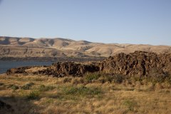
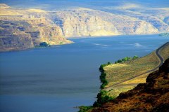
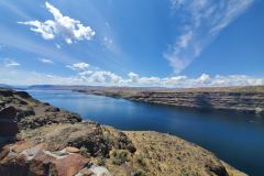
The Columbia River, the largest river in the Pacific Northwest of North America, originates in the Rocky Mountains of British Columbia, Canada. Spanning a length of 1,243 miles (2,000 kilometers), it first flows northwest, then south into the U.S. state of Washington, and subsequently turns west to form a significant portion of the border between Washington and Oregon before ultimately reaching the Pacific Ocean.
This mighty river boasts a vast drainage basin, roughly equivalent in size to France, extending into seven U.S. states and one Canadian province. With the Snake River as its largest tributary, the Columbia River ranks as the fourth-largest river in the United States by volume. It holds the notable distinction of having the greatest flow of any river entering the Pacific outside of Asia and ranks as the 36th greatest river in terms of discharge globally.
The Columbia River, with its extensive course and significant hydrological impact, plays a vital role in the geographical, ecological, and economic landscape of the regions it traverses.
Grant Coulee
Grand Coulee, located in the U.S. state of Washington, is an ancient river bed that spans approximately 60 miles (100 km) southwest from Grand Coulee Dam to Soap Lake. Designated as a National Natural Landmark, Grand Coulee is bisected by Dry Falls, forming the Upper and Lower Grand Coulee.
This geological feature holds significance for its unique landscape and the historical processes that shaped it, showcasing the intricate natural history of the region. Grand Coulee stands as a testament to the forces that have shaped the terrain over time and provides a glimpse into the geological wonders of Washington state.
Moses Lake
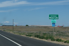
Moses Lake, situated in the U.S. state of Washington, is a lake and reservoir formed along Crab Creek, a tributary of the Columbia River. Originally a shallow natural lake, it underwent damming in the early 20th century as part of the Columbia Basin Project led by the United States Bureau of Reclamation. The purpose of this damming was primarily for irrigation, transforming Moses Lake into a key component of the project. Fed by Crab Creek and agricultural runoff, the lake’s water flow was redirected from Crab Creek to Potholes Reservoir, created by the O’Sullivan Dam. This alteration in water flow serves both irrigation needs and contributes to the management of the Columbia River basin.
Potholes Reservoir
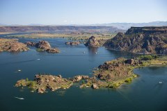
Potholes Reservoir, a key component of the Columbia Basin Irrigation Project, is situated in central Washington, USA, and is formed by the O’Sullivan Dam. The reservoir receives its water supply from Moses Lake, a part of the Crab Creek basin. Noteworthy for its unique topography, the area encompasses numerous lakes, referred to as “potholes,” ranging in width from 30 to 70 yards and depths of 10 to 30 feet.
The origin of these potholes is a combination of natural and human-induced processes. During the Pleistocene era, the depressions were initially carved out by floodwaters from Glacial Lake Missoula. Subsequent damming activities as part of the Columbia Basin Project led to the elevation of the water table, transforming these depressions into lakes. Potholes Reservoir thus stands as a testament to the interplay of natural forces and human interventions in shaping the landscape of central Washington.

Soap Lake
Soap Lake, located in the town of Soap Lake, Washington, is a meromictic soda lake positioned at the base of the Grand Coulee, formed by the Missoula Floods. The lake derives its name from the distinctive naturally occurring foam that imparts a soapy appearance to its waters.
Additionally, the lake’s mineral-rich composition contributes to a slick and soapy feel. Covering an area of approximately 2 square miles (5.2 km²) and reaching a depth of 70 feet (21 m), Soap Lake stands out for both its geological origin tied to glacial floods and its unique water characteristics, making it a notable feature in the landscape of Washington.
Columbia National Wildlife Refuge
Columbia National Wildlife Refuge, nestled in the Drumheller Channeled Scablands of central Washington, offers a picturesque blend of rugged cliffs, canyons, lakes, and sagebrush grasslands. The refuge’s diverse landscape, shaped by natural forces such as fire, ice, floods, and volcanic activity, showcases a rich geologic history. The northern section, situated south of Potholes Reservoir, known as the Drumheller Channels, is a strikingly eroded area recognized as a National Natural Landmark since 1986.
This refuge serves as a haven for migratory and wintering waterfowl, including mallard ducks, Canada geese, trumpeter swans, and tundra swans. The combination of lakes and irrigated croplands, coupled with the refuge’s protective environment and mild winters, attracts significant numbers of these avian species.
Columbia National Wildlife Refuge also offers recreational opportunities, with hunting and fishing being popular activities. Hunting, regulated by permits and specific timeframes, allows visitors to engage in this pursuit, while fishing enthusiasts can enjoy the diverse aquatic habitats within the refuge.
The refuge stands as a testament to both the dynamic geological history of the region and its significance as a haven for wildlife and outdoor enthusiasts.
Hanford Reach National Monument
Established in 2000, the Hanford Reach National Monument in Washington state encompasses the former security buffer surrounding the Hanford Nuclear Reservation. Unaltered by development or agriculture since 1943, this area is designated as an involuntary park. The monument operates from two hours before sunrise to two hours after sunset, with various zones allowing different levels of public access:
- Fitzner-Eberhardt Arid Lands Ecology Reserve: Open for ecological research but closed to the public.
- Rattlesnake Mountain: Partially within the reserve, limited access is being considered through a Congressionally-ordered process.
- Columbia River Corridor: Generally open to the public, providing access to the shore and open water.
- McGee Ranch and Riverlands: Open for public day use.
- Saddle Mountain National Wildlife Refuge: Access permitted for ecological research but closed to the public.
- Vernita Bridge: Open to the public.
- Wahluke Slope: Open to the public.
Adjacent sites within the Hanford Site, including the B Reactor, are part of the Manhattan Project National Historical Park and are accessible through public tours. The Hanford Reach National Monument thus preserves a unique landscape while offering diverse opportunities for ecological research and public engagement in specific areas.
Lake Roosevelt National Recreation Area
Lake Roosevelt National Recreation Area, situated in eastern Washington state, spans the 130-mile-long Franklin D. Roosevelt Lake, extending from Grand Coulee Dam to Northport. Originating from the construction of the Grand Coulee Dam in 1941 as part of the Columbia River Basin project, this recreation area is managed by the National Park Service.
Visitors to Lake Roosevelt National Recreation Area can enjoy a variety of activities, including fishing, swimming, canoeing, boating, hunting, and camping. The area features 22 public boat launches and four additional launches accessible by permit on the Colville Reservation. Camping options include three standard campgrounds and nine boat-in campgrounds.
In addition to outdoor pursuits, the recreation area provides opportunities for historical exploration with visits to Fort Spokane and St. Paul’s Mission. Crescent Bay Lake in Grant County, located just southwest of Lake Roosevelt, is also under the jurisdiction of the National Recreation Area.
Whether engaging in water activities, camping, or exploring historical sites, Lake Roosevelt National Recreation Area offers a diverse range of recreational opportunities within its picturesque surroundings along Franklin D. Roosevelt Lake.


