
Every year it seems for as long as I can remember property taxes have increased.
Did you know that doesn’t have to be the case?
In this article you’ll learn if you qualify to save hundreds if not thousands of dollars EVERY YEAR!!
For the rest of your life!
Pierce County, Washington has tax relief programs for senior citizens, disabled persons, and veterans that may help reduce the amount they’ll pay for their property taxes. The qualifications for this program are based on age or disability, home ownership and residency, and income.
You may be entitled to a discount on your property taxes if by December 31 of the assessment year, you are either at least 61 years of age; unable to work because of a disability; or a disabled veteran with a service-connected evaluation of at least 80% or receiving compensation from the United States Department of Veterans Affairs at the 100% rate for a service-connected disability.
You must also own your home and reside in the home as your primary residence for a minimum of 6 months each year.
For your income, it should not exceed $64,000 beginning in 2024.
If you believe that you are entitled to a discount on your property taxes, schedule a quick consultation with us and we will help you receive this benefit.
Property taxes in Pierce County are due by April 30 for the first half and the second half property taxes are due by October 31. You can pay these taxes by check or with your Visa, MasterCard, Discover, American Express, or by debit or E-Check.
If you pay through a check, make it payable to Pierce County. You can then mail it with the property tax remittance stub to the office of Pierce County Finance or to Pierce County Assessor-Treasurer’s Office.
To pay your property taxes with your Visa, MasterCard, Discover, American Express, or by debit or E-Check, just visit the Assessor-Treasurer’s online parcel search or you can call their automated telephone system provided on Pierce County’s website. You should have your parcel number ready. Enter your parcel number and follow the instructions for credit card or E-Check payments.
Take note that there will be separate fees on top of your property taxes if you pay with your Visa, MasterCard, Discover, and others.
So if you are a veteran or a senior citizen, take advantage of Pierce County’s tax relief programs and get a discount on your property taxes. Schedule an appointment with us today.
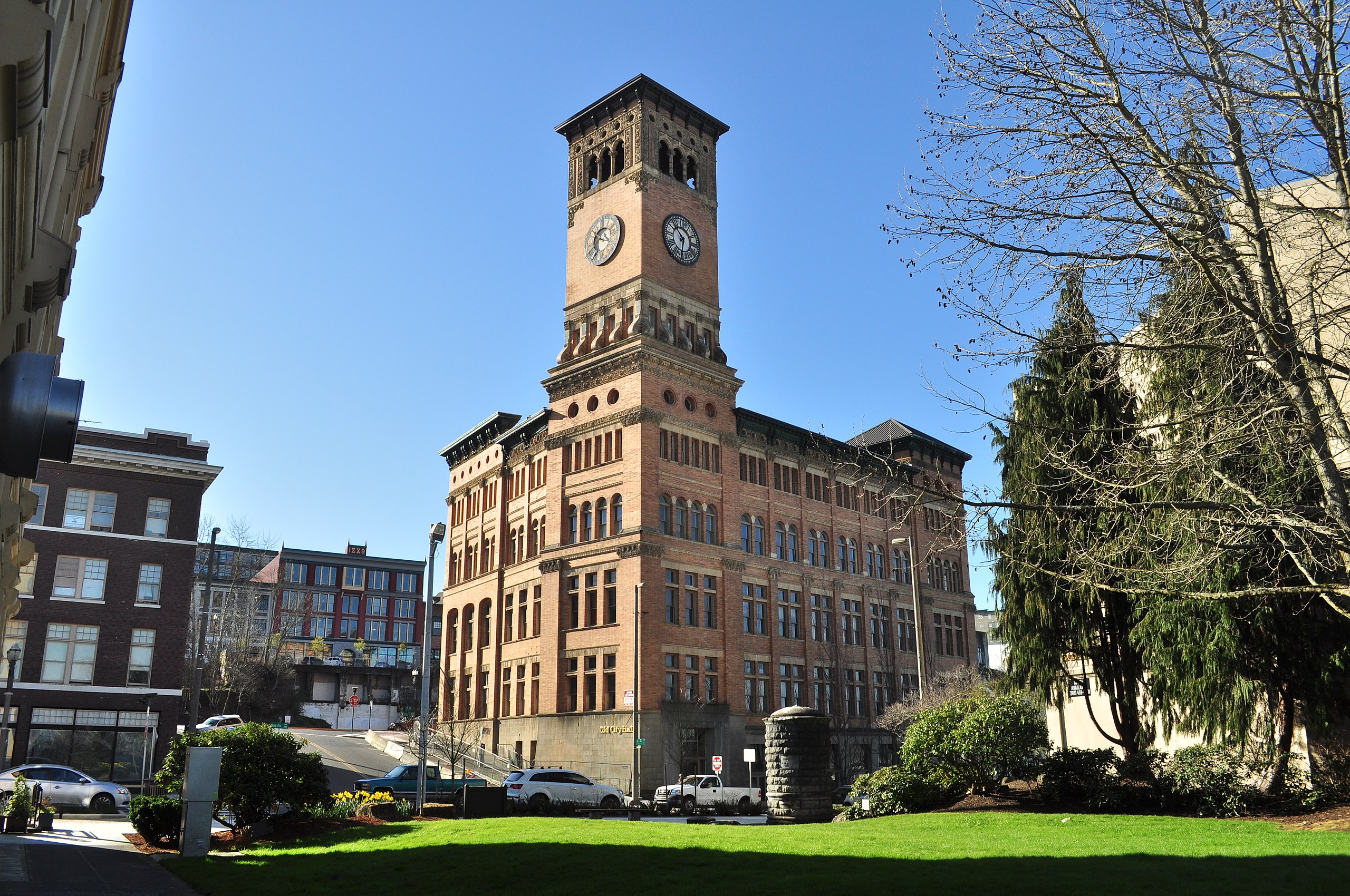
About Pierce County
Pierce County is a populous county in Washington, with a population of 921,130 as of the 2020 census. It is the second-most populous county in the state, trailing only King County, and ranks as the 60th-most populous county in the United States. Established on December 22, 1852, after separating from Thurston County, it was named in honor of U.S. President Franklin Pierce.
According to the 2010 census, the county had 795,225 residents, with a population density of 476.3 people per square mile. The county encompasses 325,375 housing units at an average density of 194.9 units per square mile.
Places You Can Visit
Ashford County Park
Ashford County Park, situated along SR706, serves as an excellent rest spot for those traveling to or from Mount Rainier National Park. Covering 80 acres of serene wetlands, the park offers ample parking, a children’s play area with nearby restrooms, and two picturesque walking trails that allow visitors to immerse themselves in the natural beauty of the surroundings.
The park boasts key features such as the Kent Mundell Memorial Trail, a 1.2-mile perimeter walking path, ADA-accessible interior paths, a children’s playground with various play elements, a Great Lawn, restrooms, parking areas, and an outdoor amphitheater operating seasonally. Additionally, 40 acres of passive forest lands contribute to the park’s tranquil atmosphere.
Cross Park
Cross Park, spanning 64 acres in the Frederickson area, serves as a focal point in the County’s urban growth zone between 176th Street East and Military Road East. The park, named Stan and Joan Cross Park, has implemented Phase 1 of its Master Plan, focusing on the northern 4 acres to provide the community with a host of amenities.
The developed area includes green spaces, a universally accessible playground, refurbished historic barns transformed into a community center, indoor and outdoor meeting spaces, walking paths, picnic areas, and convenient on-site parking. Visitors can immerse themselves in nature by exploring pathways and enjoying picnics near wetlands and forested areas, adjacent to the enhanced Naches Trail Preserve prairie habitat.
With a rich history dating back to Native Americans and pioneer days, Cross Park holds significance in the Frederickson community. The mid-1930s saw the establishment of the Mayflower Dairy hay and milking farm, which became a staple. The land, part of the Frederick Meyer Land Donation Claim in the mid-1800s, was later acquired by Stan and Joan Cross in 1973. The family maintained the property, including the irrigation rights from Clover Creek, until its sale to Pierce County in 2003. Cross Park thus stands as a testament to the area’s heritage, offering a blend of history and contemporary amenities for community enjoyment.
Lidford Playfield
Lidford Playfield is a charming 9-acre neighborhood park situated at the intersection of 60th Street and 44th Avenue in east Tacoma. This inviting green space offers various amenities, including expansive open lawns, a gravel walking path, ADA-accessible parking for convenience, and newly installed play equipment complete with fall surfacing. The park prioritizes accessibility, featuring an ADA access ramp and a concrete connection to the gravel walking path, ensuring a welcoming and inclusive recreational environment for all visitors.
Meridian Habitat Park
Meridian Habitat Park, affectionately known as the Puyallup Amphitheatre, is a scenic 36-acre wooded park featuring a vibrant community center and expansive great lawn. This dynamic space hosts a variety of popular programs, including jazzercise, movies in the park, princess parties, and family Bingo nights. The park is equipped with a fully fenced off-leash dog park, providing a serene environment for dogs and their owners to enjoy.
Key Amenities at Meridian Habitat Park:
- Community Center: A central hub for activities and events.
- Nature Playground: Complete with park benches for leisure.
- Environmental Education Space: Fostering learning and appreciation for nature.
- Off-leash Dog Park: A secure area for canine companions to play freely.
- Paved and Gravel Loop Trails: Ideal for walking and jogging.
- Art Structure: Adding an artistic touch to the park.
- Wooded Areas: Providing a natural and tranquil setting.
- Wetlands and Wildlife Habitats: A diverse ecosystem for various species.
- Parking Area: Convenient parking for visitors.
Meridian Habitat Park is a versatile community space that caters to diverse interests, fostering a sense of community through its range of amenities and engaging programs.
Parkland Prairie
Parkland Prairie, a 4.5-acre urban nature preserve, stands as a cherished gem for nature enthusiasts. Nestled along the south edge of the prairie, Clover Creek meanders through this serene landscape. The prairie showcases its natural beauty with a grove of newly planted Garry Oaks and a variety of native plants, including the vibrant blue camas and the resilient Idaho fescue. The preserve boasts a rich biodiversity, featuring 15 different native grass and flower species, making it an ideal destination for those seeking to immerse themselves in the wonders of the natural world. Parkland Prairie is not only a testament to urban conservation but also a haven for those who appreciate the diverse flora and fauna that thrive in this carefully preserved ecosystem.
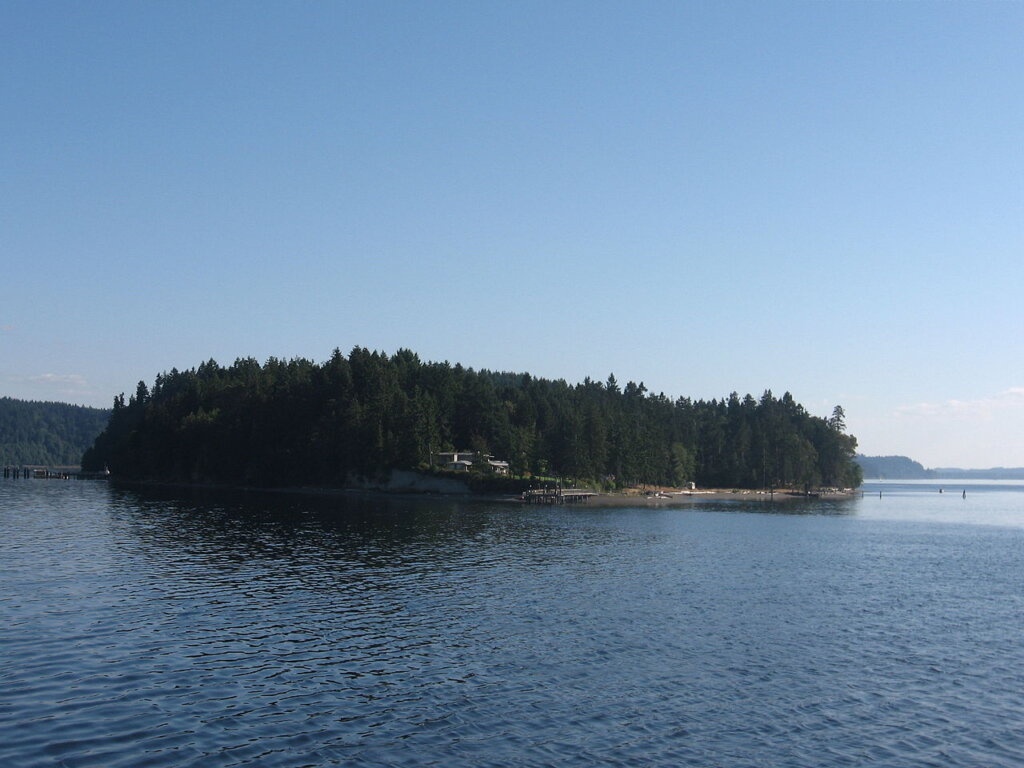
Anderson Island
Anderson Island, located in Puget Sound, is the southernmost island in this picturesque region and serves as a census-designated place within Pierce County, Washington, United States. Accessible by either boat or a convenient 20-minute ferry ride from Steilacoom, the island is situated just south of McNeil Island. Drayton Passage to the northwest separates Anderson Island from Key Peninsula, while to the southeast, the south basin of Puget Sound creates a natural boundary between the island and the mainland. Additionally, the Nisqually Reach of Puget Sound lies to the southwest, further accentuating Anderson Island’s unique location in this scenic maritime environment.

Carbon River
The Carbon River, located in the state of Washington, spans approximately 30 miles from its origin at the Carbon Glacier on Mount Rainier to its confluence with the Puyallup River in Orting. Originally referred to as the “Upthascap River” by Charles Wilkes, its name underwent a transformation in 1876 when coal deposits were uncovered along its banks, leading to the adoption of the name “Carbon River.” This watercourse showcases the geological and historical significance of the region, tracing a path from the iconic Carbon Glacier down to its merging point with the Puyallup River.

Cascade Range
The Cascade Range, also known as the Cascades, is a prominent mountain range in western North America, spanning from southern British Columbia through the states of Washington and Oregon to Northern California. This expansive range encompasses a diverse landscape, featuring non-volcanic mountains in areas like the North Cascades, as well as the distinctive volcanoes recognized as the High Cascades.
Mount Rainier, soaring to an impressive height of 14,411 feet (4,392 m), stands as the highest peak within the Cascade Range. This mountainous region holds both geological and ecological significance, offering a varied terrain that includes volcanic peaks, alpine meadows, and dense forests. The Cascade Range is a defining feature of the Pacific Northwest, attracting outdoor enthusiasts, scientists, and nature lovers alike.
Commencement Bay
Commencement Bay, situated within Puget Sound in the state of Washington, is a significant geographic feature where the city of Tacoma is strategically positioned along its shores. The bay encompasses a vast expanse, with the Port of Tacoma occupying the southeastern extremity. A demarcation line, extending from Point Defiance in the southwest to Browns Point in the northeast, serves as a widely recognized boundary, distinguishing the bay from the open waters of Puget Sound.
Commencement Bay has evolved into a bustling hub of economic activity, hosting one of the most dynamic commercial ports globally. The Port of Tacoma, located on the bay, stands as the primary facility, playing a pivotal role in facilitating maritime trade and commerce. With its strategic location and economic significance, Commencement Bay serves as a vital component of the regional landscape, contributing to the economic vitality and connectivity of the broader Puget Sound area.

Fox Island
Fox Island, a charming island and census-designated place (CDP) in Pierce County, Washington, graces the waters of Puget Sound, situated about 5 miles (8 km) from Gig Harbor. The island’s name, bestowed by Charles Wilkes during the United States Exploring Expedition, pays homage to J.L. Fox, an assistant surgeon who played a crucial role in the expedition. With its picturesque location and historical significance, Fox Island offers a tranquil retreat in the Puget Sound region, contributing to the area’s maritime heritage and natural beauty.

Herron Island
Herron Island, nestled in central Case Inlet in the southern part of Puget Sound, Washington, is a unique and privately owned island. With a land area of 1.2326 km² (304.57 acres) and a population of 151 individuals based on the 2010 census, Herron Island stands out as one of the few privately owned islands in Puget Sound.
Access to the island is exclusively by boat, primarily the HMC ferry named “Charlie Wells,” and entry requires a guest pass signed by an HMC member. The island, spanning 1.25 miles (2.01 km) in length and 1/2 mile (800 m) across, offers a serene and secluded environment.
Corporate properties on Herron Island include North Beach Park, small boat docks, South Beach (undeveloped), roads and rights of way, Goodpastor Park with adjacent wetlands, the Community Building and Fire Station, water systems, ferry, ferry docks, and several greenbelt lots throughout the island. Notably, all other land on the island is privately owned, with waterfront lots extending ownership to the tidelands down to the mean sea level. Herron Island, with its exclusive access and private ownership, creates a distinctive and tranquil island community in the Puget Sound region.
Ketron Island
Ketron Island, situated in southern Puget Sound as a census-designated place (CDP) in Pierce County, Washington, is a tranquil and sparsely populated island. With a population of 24 individuals recorded in the 2000 census, and 17 persons in the 2010 census, Ketron Island provides a secluded haven in close proximity to Steilacoom.
This island, encompassing 221 acres (89 hectares), rests between the mainland near the city of Steilacoom and Anderson Island, marking the extreme south end of Puget Sound. Known for its modest population and serene surroundings, Ketron Island stands as a distinctive presence in the Puget Sound region, offering a peaceful escape from the nearby mainland hustle.
Lake Tapps
Lake Tapps, located in Pierce County, Washington, is a reservoir with a rich history. Originally created in 1911 by Puget Sound Power & Light for hydroelectric power, it transitioned into a significant water resource after ceasing power production in 2004. The Cascade Water Alliance, a collective of municipalities in King County, took ownership of the reservoir with a purpose to supply drinking water to approximately 350,000 residents and 20,000 businesses.
Despite its primary role as a water source, Lake Tapps remains open for recreational use, thanks to an agreement between Cascade and homeowners along its shores. This agreement ensures the maintenance of specific reservoir levels during the summer months, allowing residents and visitors to enjoy the lake for various recreational activities. Lake Tapps stands as a multifaceted resource, providing both essential water services and recreational opportunities to the surrounding communities.

McNeil Island
McNeil Island, situated in south Puget Sound, northwest of Tacoma, Washington, holds a significant place in history. With a land area of 6.63 square miles (17.2 km2), it is positioned just north of Anderson Island, bordered by Fox Island to the north, Key Peninsula to the west, and the Washington mainland to the east across the south basin of Puget Sound.
For much of its history, McNeil Island has been government-owned, serving as the location for a federal penitentiary from 1875 to 1981. Subsequently, the Washington State Department of Corrections took over, transforming it into the McNeil Island Corrections Center until its closure in 2011. Remarkably, McNeil Island was the last island prison in the country accessible only by air and sea.
In a cost-saving measure, the state announced closure plans in November 2010, effectively shutting down the facility in 2011. Although the correctional center closed, a detention center for violent sexual offenders remains on the island, ensuring that McNeil Island continues to play a role in the state’s criminal justice system. The island’s storied past and evolving functions make it a unique and historically significant location in the Puget Sound region.
Mount Rainier
Mount Rainier, known as Tahoma, stands as a prominent and active stratovolcano in the awe-inspiring Cascade Range of the Pacific Northwest in the United States. Situated in Mount Rainier National Park, approximately 59 miles (95 km) south-southeast of Seattle, this majestic mountain boasts a summit elevation of 14,411 feet (4,392 m). Not only is Mount Rainier the highest peak in the state of Washington, but it also holds the distinction of being the most topographically prominent mountain in the contiguous United States and the tallest in the Cascade Volcanic Arc.
The park surrounding Mount Rainier offers a myriad of activities, making it a haven for outdoor enthusiasts. Climbing the peak is a popular pursuit, but the park also welcomes visitors with opportunities for hiking, backcountry skiing, photography, and camping. Well-maintained hiking trails, including the famed Wonderland Trail—a 93-mile (150 km) circumnavigation of the peak—provide access to the captivating backcountry. Winter sports enthusiasts can partake in snowshoeing and cross-country skiing, ensuring year-round enjoyment of this iconic natural wonder. Mount Rainier’s breathtaking beauty and diverse recreational offerings make it a cherished destination for those seeking adventure in the heart of the Pacific Northwest.

Nisqually River
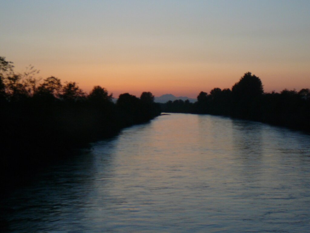
The Nisqually River, spanning approximately 81 miles (130 km), gracefully winds through west central Washington in the United States. Originating in the Cascade Range southeast of Tacoma, it serves as a vital watercourse, draining the southern slope of the iconic Mount Rainier. The river’s journey culminates as it gracefully empties into the southern end of Puget Sound. The Nisqually River, with its scenic course and connection to the majestic Cascade Range, contributes to the natural beauty and ecological diversity of the Puget Sound region.

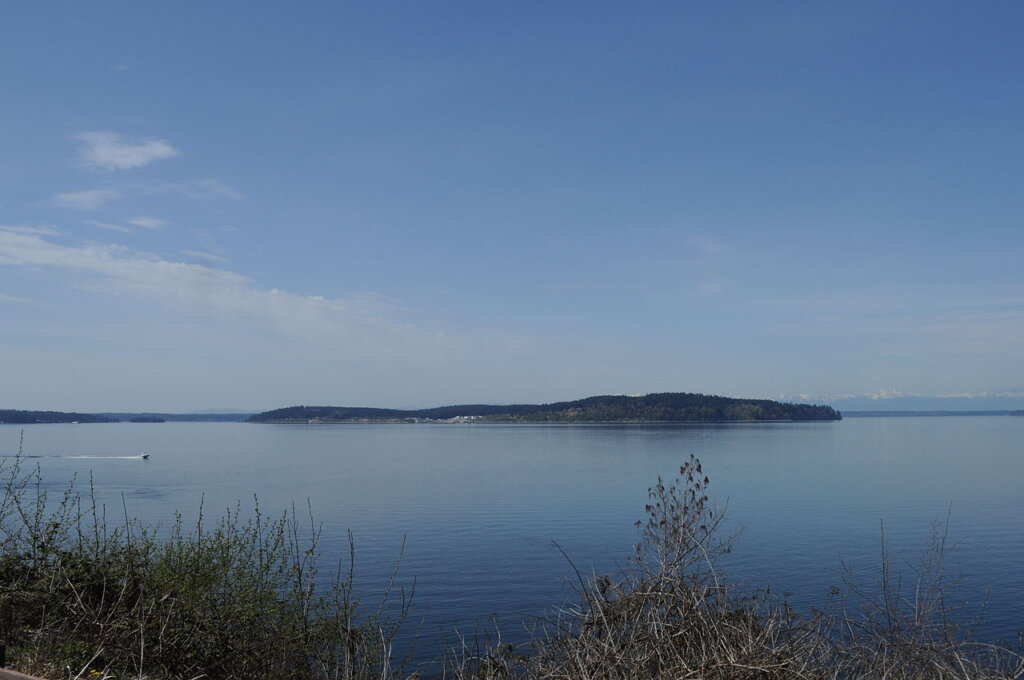
Puget Sound
Puget Sound, a defining feature of the Pacific Northwest, stands as a notable sound, inlet of the Pacific Ocean, and integral component of the Salish Sea. Nestled along the northwestern coast of the U.S. state of Washington, Puget Sound is a complex estuarine system characterized by a network of interconnected marine waterways and basins. This intricate system boasts connections to the open Pacific Ocean through three key passages—the major connection being Admiralty Inlet, complemented by the minor connections of Deception Pass and Swinomish Channel—via the strategic Strait of Juan de Fuca. The unique geography and marine diversity of Puget Sound contribute to its significance as a natural and cultural landmark within the Pacific Northwest.

Puyallup River
The Puyallup River, a river in the state of Washington, carves a path of approximately 45 miles (72 km) as it originates from glaciers on the western slopes of the iconic Mount Rainier. Flowing in a general northwest direction, the river eventually converges with Commencement Bay, an integral part of Puget Sound. The extensive drainage network of the Puyallup River, along with its tributaries, covers an expansive area of about 948 square miles (2,460 km2), encompassing regions in Pierce County and southern King County. This river system plays a vital role in shaping the landscape of the Pacific Northwest and contributes to the ecological richness of the surrounding areas.
Tacoma Narrows
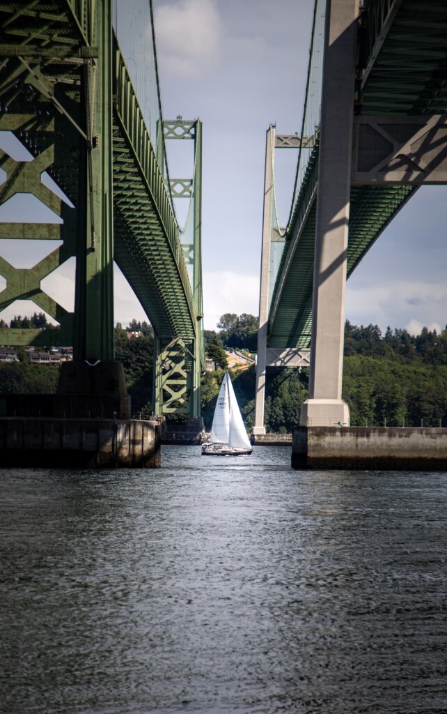
The Tacoma Narrows, a notable strait within Puget Sound in Washington state, serves as a navigable maritime waterway that divides the Kitsap Peninsula from the city of Tacoma. Carved by glacial landforms, this picturesque strait has long been a distinctive feature of the region, offering both natural beauty and strategic importance.
Connecting these landforms are the twin Tacoma Narrows Bridges, which carry State Route 16 across the Narrows. These iconic bridges not only provide a vital transportation link between the Kitsap Peninsula and Tacoma but also stand as engineering marvels, symbolizing the resilience and innovation of infrastructure in the Pacific Northwest. The Tacoma Narrows, with its scenic vistas and engineering significance, plays a pivotal role in the maritime and transportation landscape of the state of Washington.
Mount Baker–Snoqualmie National Forest
The Mount Baker–Snoqualmie National Forest, a vast expanse in Washington, stretches over 140 miles along the western slopes of the Cascade Range, extending from the Canada–US border to the northern boundary of Mount Rainier National Park. Encompassing portions of Snohomish, Whatcom, Skagit, King, Pierce, and Kittitas counties, this national forest is a diverse and expansive natural treasure with a total area of 1,724,229 acres (6,978 km2).
Comprising four ranger districts, the forest’s ranger stations are strategically located in Glacier, Sedro-Woolley, Darrington, Verlot, Skykomish, North Bend, and Enumclaw. The Mount Baker–Snoqualmie National Forest, with its rich geographical range, offers a variety of recreational opportunities.
Given its proximity to central Puget Sound counties, a significant portion of the state’s population, approximately 62% or 3.63 million people, resides within a 70-mile drive of the forest. Additionally, the forest is easily accessible to another 1.5 million individuals in the Vancouver metropolitan area. This accessibility, coupled with the large population factor, makes the Mount Baker–Snoqualmie National Forest the most visited national forest in the country, attracting visitors with its stunning landscapes and diverse ecosystems.


Mount Rainier National Park
Mount Rainier National Park, located in southeast Pierce County and northeast Lewis County, Washington, holds a special place as the fourth national park established in the United States. Its creation on March 2, 1899, preserved a vast expanse of 236,381 acres, encapsulating the entirety of Mount Rainier, a magnificent 14,410-foot (4,390 m) stratovolcano. The park boasts diverse elevations, ranging from 1,600 feet to over 14,000 feet (490–4,300 m), and encompasses the highest point in the Cascade Range.
Mount Rainier, rising dramatically from its surroundings, is surrounded by picturesque valleys, cascading waterfalls, subalpine meadows, and 91,000 acres of old-growth forest. The mountain’s grandeur is enhanced by the presence of over 25 glaciers, covering approximately 35 square miles (91 km2). Notably, Carbon Glacier stands as the largest glacier by volume in the contiguous United States, while Emmons Glacier claims the title of the largest by area.
The Wonderland Trail encircles Mount Rainier, offering a captivating journey through its glacier-covered slopes and pristine landscapes. The mountain’s allure extends to mountaineers, with around 10,000 attempts to summit annually, and approximately half of them successfully reaching the peak. Mount Rainier National Park, with its breathtaking scenery, diverse ecosystems, and mountaineering opportunities, remains a cherished destination and a testament to the natural wonders of the Pacific Northwest.


Billy Frank Jr. Nisqually National Wildlife Refuge
The Billy Frank Jr. Nisqually National Wildlife Refuge stands as a vital wildlife preserve managed by the United States Fish and Wildlife Service. Nestled on the Nisqually River Delta near Puget Sound, this refuge is situated in northeastern Thurston County, Washington, and northwestern Pierce County, Washington. Conveniently located just off Interstate 5, between the cities of Tacoma and Olympia, the refuge plays a crucial role in conserving and protecting the diverse ecosystems of the Nisqually River Delta. Its strategic location and commitment to wildlife conservation make it a significant natural sanctuary in the Pacific Northwest.