
Every year it seems for as long as I can remember property taxes have increased.
Did you know that doesn’t have to be the case?
In this article you’ll learn if you qualify to save hundreds if not thousands of dollars EVERY YEAR!!
For the rest of your life!
Chelan County offers tax relief programs to qualified individuals such as senior citizens and disabled persons.
You may be entitled to the county’s property tax discount if you are a senior citizen 61 years or older or a disabled person, with your primary residence in Washington State, and your income does not exceed $48,000 starting 2024.
If you are a disabled veteran with an 80% service-connected disability and your income does not also exceed $48,000 beginning 2024, you may be entitled to a property tax reduction. Schedule an appointment with our team today and we will show you how you can receive this benefit fast.
Taking advantage of the property tax discount you deserve is a big relief to your pocketbook, especially if you live in Wenatchee. If you look at Chelan’s 2023 Property Tax Summary Report from the Assessor’s Office, Wenatchee has been one of the costliest places to live since 2010.
Wenatchee ranked 194th in 2010 with the cost of living 5% lower than the national average. But in 2021, Wenatchee climbed 158 positions and landed at the 36th spot, with the cost of living around 3% more expensive than the national average.
Also, Chelan County has one of the highest median property taxes in the United States, and is ranked 462nd of the 3143 counties in order of median property taxes, although the 2023 County wide average levy rate in Chelan County is about $7.77 per $1,000 of assessed valuation, which is down from the average levy rate in 1999 of $12.57.
Still, you are living in a county with one of the highest median property taxes in the U.S.
There are ways to alleviate the high cost of living. You can follow a strict budget scheme or look for ways to increase your income. But as a senior citizen, disabled person, or a disabled veteran, you have one of the easiest and immediate accesses to reducing the high cost of living – tax relief programs provided for you.
Here at Property Tax Discount, we will help you get this benefit the easiest and fastest way possible. Schedule an appointment with us today.
About Chelan County
Chelan County is a county in the U.S. state of Washington with a population of 79,074 based on the 2020 census. It derives its name from a Chelan Indian word meaning “deep water,” likely a reference to 55-mile (89 km)-long Lake Chelan, which reaches a maximum depth of 1,486 feet (453 m)1https://en.wikipedia.org/wiki/Chelan_County,_Washington.
The county is the third-largest in Washington by area. Some of its geographic features include Bonanza Peak, which is the highest point in Chelan, Cascade Mountains, Chelan Mountains, and many more.
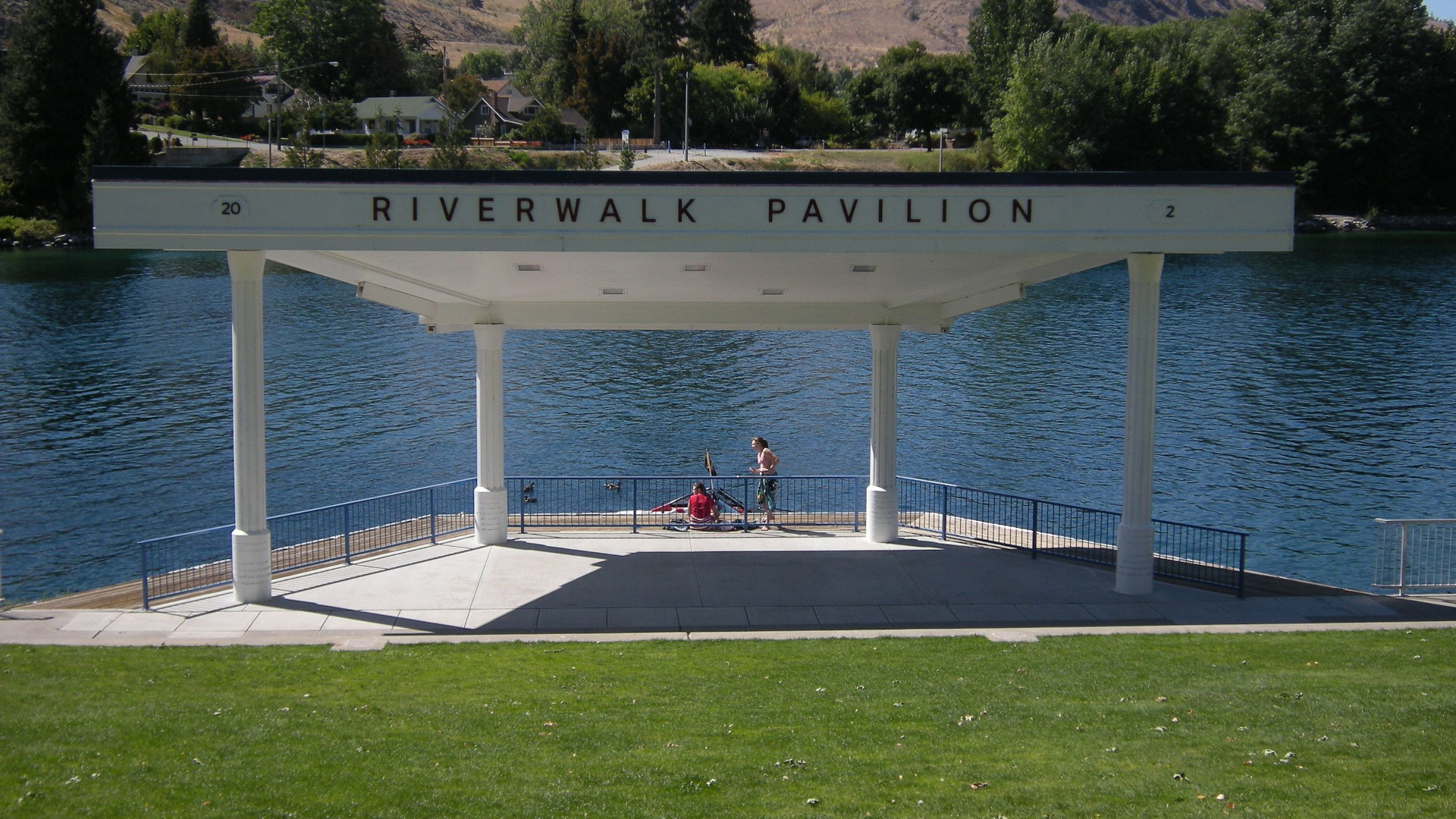
Wenatchee County Park
You can also find the Wenatchee County Park located in the very middle of Washington on Highway 2 and the Wenatchee River2https://www.wenatcheeriverpark.org. There are plenty of amenities in the Park that include laundry facilities, showers, restrooms, a sand-filled volleyball court, horseshoes, basketball hoop, an Outdoor Ping Pong Table, and many more. For the kids, it has a playground area and a swing set. It also includes a post office, a small store, and a restaurant within walking distance. For those who into antique things, there are shops a few minutes from the Park. If you are a wine connoisseur, there are many wineries in the area.


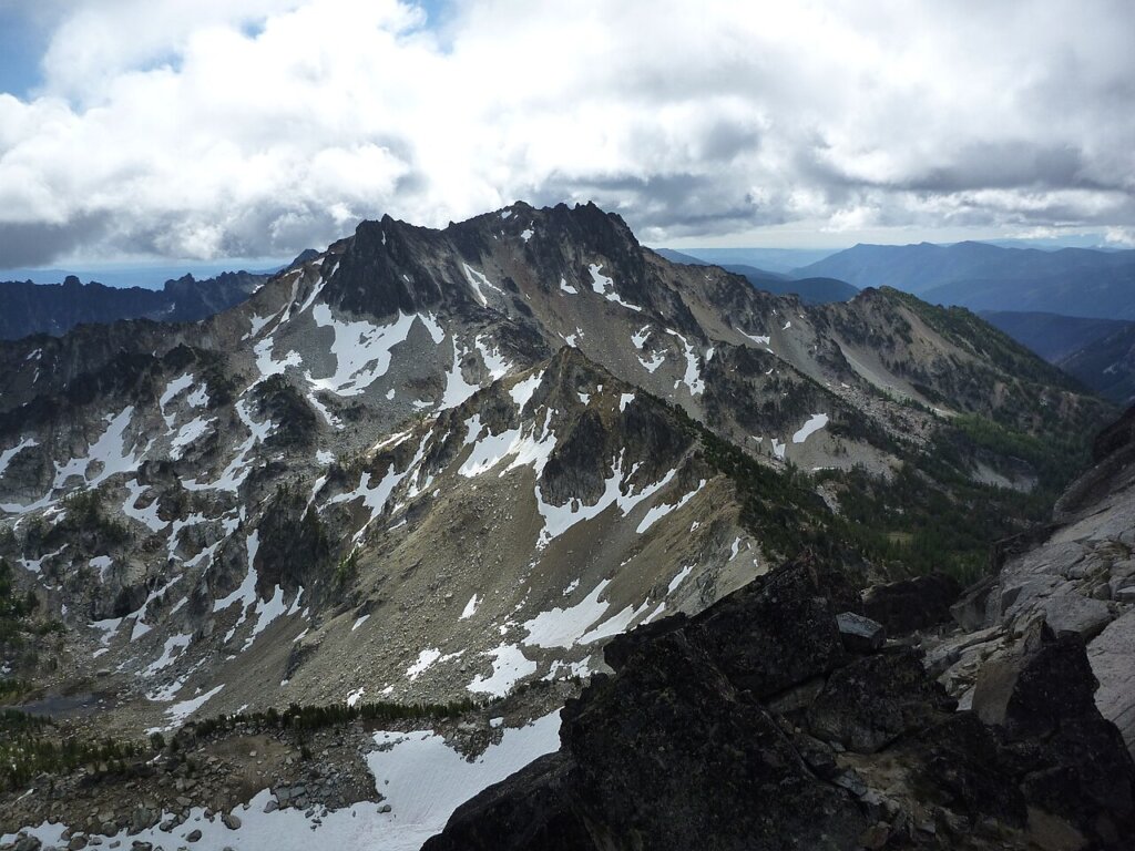
Bonanza Peak
Bonanza Peak is a tall peak in the North Cascades in the U.S. state of Washington and the Glacier Peak Wilderness of the Wenatchee National Forest3https://en.wikipedia.org/wiki/Bonanza_Peak_(Washington). At 9,516 feet (2,900 m) in elevation, it is the highest point in Chelan County, and the highest non-volcanic peak in Washington[4] and the Cascade Range as a whole. Bonanza Peak’s prominence is 3,711 feet (1,131 m), making it the 26th most prominent peak in Washington. The nearest higher peak is Glacier Peak, 14.4 miles (23.2 km) to the southwest.


Cascade Range
The Cascade Range or Cascades is a major mountain range of western North America, extending from southern British Columbia through Washington and Oregon to Northern California4https://en.wikipedia.org/wiki/Cascade_Range. It includes both non-volcanic mountains, such as many of those in the North Cascades, and the notable volcanoes known as the High Cascades. The small part of the range in British Columbia is referred to as the Canadian Cascades or, locally, as the Cascade Mountains. The highest peak in the range is Mount Rainier in Washington at 14,411 feet (4,392 m).


Chelan Mountains
The Chelan Mountains, or Chelan Range is a mountain range in the U.S. state of Washington5https://en.wikipedia.org/wiki/Chelan_Mountains. Located west of the Columbia River, north of the Entiat River, and south of Lake Chelan, the range is part of the North Cascades section of the Cascade Range. The Chelan Range is about 40 mi (64 km) long northwest to southeast and about 8 mi (13 km) wide, southwest to northeast.
Chiwaukum Mountains
The Chiwaukum Mountains are a north–south mountain range in central Washington, United States6https://en.wikipedia.org/wiki/Chiwaukum_Mountains. The mountains are made of schist, part of the Nason terrane. The original rock in the Nason terrane was laid down 210 Myr ago.


Columbia River
The Columbia River is the largest river in the Pacific Northwest region of North America7https://en.wikipedia.org/wiki/Columbia_River. The river forms in the Rocky Mountains of British Columbia, Canada. It flows northwest and then south into the U.S. state of Washington, then turns west to form most of the border between Washington and the state of Oregon before emptying into the Pacific Ocean. The river is 1,243 miles (2,000 kilometers) long, and its largest tributary is the Snake River. Its drainage basin is roughly the size of France and extends into seven states of the United States and one Canadian province. The fourth-largest river in the United States by volume, the Columbia has the greatest flow of any North American river entering the Pacific. The Columbia has the 36th greatest discharge of any river in the world.


Entiat Mountains
The Entiat Mountains, or Entiat Range, is a mountain range in the U.S. state of Washington8https://en.wikipedia.org/wiki/Entiat_Mountains. Located west of the Columbia River, north of the Wenatchee River, and south of the Entiat River, the range is part of the North Cascades section of the Cascade Range.


Entiat River
The Entiat River is a tributary of the Columbia River, joining the Columbia near Entiat9https://en.wikipedia.org/wiki/Entiat_River. The United States Geological Survey (USGS) lists two variant names for the Entiat River: En-ti-at-kwa River and Entiatqua River. The river’s name is derived from the Columbia-Moses (Salishan) term /nt’yátkw/ [nt’iátkw], meaning “place of grassy water”; another source states that it was called Enteatqua which means “Rapid Water” or “Rushing Water.” The name, spelled “Entiat”, was selected for the river in 1958 by the Chelan County Public Utility District.
Lake Chelan
Lake Chelan is a narrow, 50.5 mi (81.3 km) long lake in Chelan County, north-central Washington state, U.S.10https://en.wikipedia.org/wiki/Lake_Chelan It is an overdeepened lake and resembles a fjord, with an average width of 1.3 mi (2.1 km). Near its upper end, the lake surface lies more than 6,600 ft (2,000 m) below peaks less than 3 mi (4.8 km) away. Before 1927, Lake Chelan was the largest natural lake in the state in terms of both surface area and water volume. Upon the completion of Lake Chelan Dam in 1927, the elevation of the lake was increased by 21 ft (6.4 m) to its present maximum-capacity elevation of 1,100 ft (340 m).


Lake Wenatchee
Lake Wenatchee is a glacier- and snowmelt-fed lake situated in the Wenatchee National Forest on the eastern slopes of the Cascades Mountain Range in the state of Washington11https://en.wikipedia.org/wiki/Lake_Wenatchee. Lake Wenatchee covers 2,480 acres (1,000 ha) and reaches a depth of 244 feet (74 m). Lake Wenatchee is the source of the Wenatchee River. Its main tributaries are the White River and the Little Wenatchee River. At its eastern end, the lake is breasted by Lake Wenatchee State Park.


Stuart Range
The Stuart Range is a mountain range in central Washington, United States12https://en.wikipedia.org/wiki/Stuart_Range. The range lies within the eastern extent of the Cascade Range immediately southwest of Leavenworth and runs east–west. The western peaks make up a single sharp ridge. The eastern half of the range splits into two parallel ridges, the northern of which is known as the Enchantment Peaks. Between these ridges lies the Enchantment Basin, which holds the dozens of tarns known as the Enchantment Lakes. Collectively, the basin and the encircling eastern peaks of the Stuart Range make up The Enchantments, a well-known backpacking destination. The south face of the Stuart Range falls off steeply to Ingalls Creek, beyond which rise the roughly parallel Wenatchee Mountains.


The Enchantments
The Enchantments is a region within the Alpine Lakes Wilderness area of Washington state’s Cascade Mountain Range13https://en.wikipedia.org/wiki/The_Enchantments. At an elevation of 4,500 feet (1,372 m), it is home to over 700 alpine lakes and ponds surrounded by the vast peaks of Cashmere Crags, which rate among the best rock-climbing sites in the western United States. The highest peak, Dragontail Peak, stretches 8,840 feet (2,694 m) high. The Enchantments is located 15 miles southwest of the popular Bavarian-themed town Leavenworth, Washington in the United States and is regarded as one of the most spectacular regions in the Cascade Range.


Wenatchee Mountains
The Wenatchee Mountains are a range of mountains in central Washington State, United States of America14https://en.wikipedia.org/wiki/Wenatchee_Mountains. A major subrange of the Cascade Range, extending east 50 miles (80 km) from the Cascade crest, the Wenatchee Mountains separate the drainage basins of the Yakima River from the Wenatchee River. The crest of the range forms part of the boundary between Chelan and Kittitas Counties.


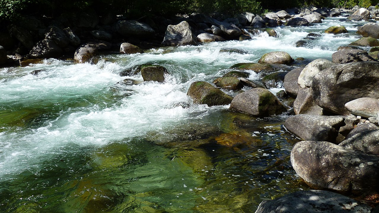
Wenatchee River
The Wenatchee River is a river in the U.S. state of Washington, originating at Lake Wenatchee and flowing southeast for 53 miles (85 km), emptying into the Columbia River immediately north of Wenatchee, Washington15https://en.wikipedia.org/wiki/Wenatchee_River. On its way it passes the towns of Plain, Leavenworth, Peshastin, Dryden, Cashmere, Monitor, and Wenatchee, all within Chelan County. The river attracts kayaking and river rafting enthusiasts and tourism.


National Protected Areas
Lake Chelan National Recreation Area
Lake Chelan National Recreation Area is a national recreation area located about 35 miles (56 km) south of the Canada–US border in Chelan County, Washington16https://en.wikipedia.org/wiki/Lake_Chelan_National_Recreation_Area. It encompasses an area of 61,958 acres (25,074 ha) including the northern end of Lake Chelan and the surrounding area of the Stehekin Valley and the Stehekin River. The area is managed by the U.S. National Park Service as part of the North Cascades National Park Service Complex.


North Cascades National Park (Part)
North Cascades National Park is an American national park in the state of Washington17https://en.wikipedia.org/wiki/North_Cascades_National_Park. At more than 500,000 acres (200,000 ha), it is the largest of the three National Park Service units that comprise the North Cascades National Park Complex. North Cascades National Park consists of a northern and southern section, bisected by the Skagit River that flows through the reservoirs of Ross Lake National Recreation Area. Lake Chelan National Recreation Area lies on the southern border of the south unit of the park. In addition to the two national recreation areas, other protected lands including several national forests and wilderness areas, as well as Canadian provincial parks in British Columbia, nearly surround the park. North Cascades National Park features the rugged mountain peaks of the North Cascades Range, the most expansive glacial system in the contiguous United States, the headwaters of numerous waterways, and vast forests with the highest degree of flora biodiversity of any American national park.


Wenatchee National Forest (Part)
Wenatchee National Forest is a U.S. National Forest located in Washington18https://en.wikipedia.org/wiki/Wenatchee_National_Forest. With an area of 1,735,394 acres (2,711.55 sq mi, or 7,022.89 km2), it extends about 137 miles along the eastern slopes of the Cascade Range of Washington, USA from Okanogan National Forest to Gifford Pinchot National Forest. The forest is located in Chelan, Kittitas and Yakima counties.


Alpine Lakes Wilderness
The Alpine Lakes Wilderness is a large wilderness area spanning the Central Cascades of Washington state in the United States19https://en.wikipedia.org/wiki/Alpine_Lakes_Wilderness. The wilderness is located in parts of Wenatchee National Forest and Snoqualmie National Forest, and is approximately bounded by Interstate 90 and Snoqualmie Pass to the south and U.S. Route 2 and Stevens Pass to the north. The Alpine Lakes is the largest wilderness area near the population centers of Puget Sound, counted at 414,161 acres (167,605 ha) following the 2014 expansion.