
Every year it seems for as long as I can remember property taxes have increased.
Did you know that doesn’t have to be the case?
In this article you’ll learn if you qualify to save hundreds if not thousands of dollars EVERY YEAR!!
For the rest of your life!
Clark County has limited property tax relief programs to specific classes of individuals such as senior citizens and disabled persons. According to the 2023 Assessor’s Report, the State Legislature voted to increase the qualifying senior and disabled veteran exemption level from 65% to 70% of the county’s median household income. In Clark County, the income levels will change for the 2024 property tax year.
By December 31 of any assessment year, if you are a senior citizen at least 61 years of age or unable to work because of a disability, both a homeowner and an occupant, and with an income of $62,000 or less beginning 2024, you may be qualified for a property tax discount. If you think you are entitled to this benefit, schedule an appointment with our team today to know how to get this benefit.
If you are a disabled veteran with an 80% service-connected disability, own and occupy your residence, and your combined disposable income does not exceed $62,000 starting 2024, you may also be qualified for a property tax discount.
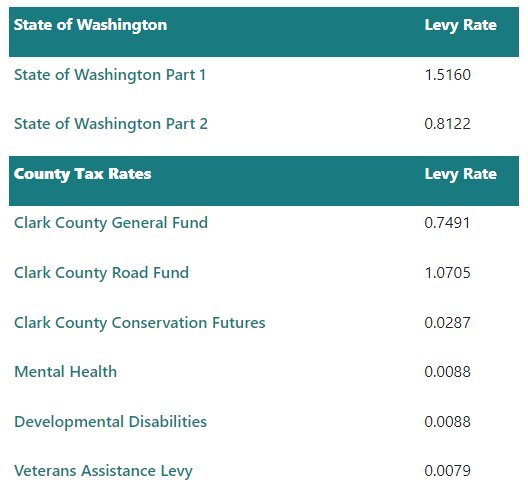
Your property taxes may vary, but the picture below will give you a general idea on what is the tax rate in Clark County, Washington as of 2023:
Washington State taxes can be paid twice a year. In Clark County, the first half is due by April 30 and the second half is due by October 31.
You don’t have to pay for your property tax discount by yourself. If you think you are entitled to a reduction on your property tax, schedule an appointment with our team today.
About Clark County
Clark County is the southernmost county in the U.S. state of Washington. As of the 2020 census, the population was 503,311, making it Washington’s fifth-most populous county1https://en.wikipedia.org/wiki/Clark_County,_Washington.
It was the first county in Washington, first named Vancouver County in 1845 before being renamed for William Clark of the Lewis and Clark Expedition in 1849. It was created by the Provisional Government of Oregon in Oregon Country on August 20, 1845, and at that time covered the entire present-day state.
There were 167,413 housing units at an average density of 266.2 units per square mile (102.8 units/km2) in the 2010 census.
Natural Areas for Hikes
Gordy Jolma Family Natural Area
The Gordy Jolma Family Natural Area, spanning 118 acres and situated next to the Salmon-Morgan Creeks Natural Area, serves as a valuable addition supporting open space, regional water quality, and salmon recovery objectives. In addition to contributing to environmental goals, the property is expected to enhance recreational opportunities within the region.
Hazel Dell Community Park
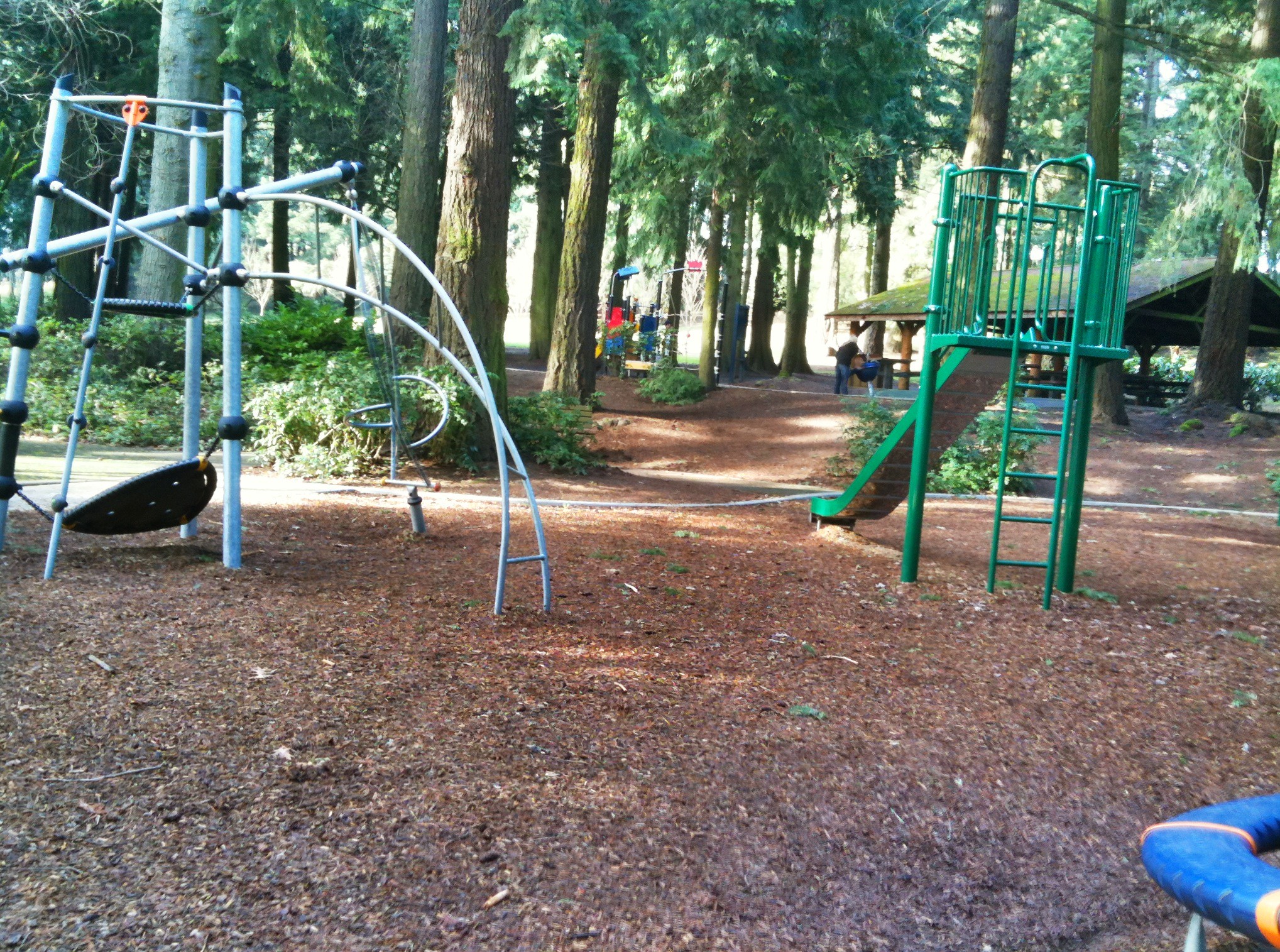
Hazel Dell Community Park, a historic 20-acre site, stands as one of the inaugural community parks established in the county. Its facilities include two picnic shelters equipped with electricity and water, three barbecue grills, an ample arrangement of 34 picnic tables, two drinking fountains for visitor convenience, two pieces of play equipment for recreational activities, and a restroom facility. This park serves as a well-equipped and welcoming space for community members to gather, engage in outdoor activities, and enjoy the amenities provided.
Luke Jensen Sports Park
Luke Jensen Sports Park in Washington State is a distinguished recipient of the Clark County Community Pride Design Awards in 2012. Valued at $9.1 million, this 20-acre multipurpose facility, developed in 2011-2012 through the Greater Clark Parks District program, stands as a testament to innovative design and community pride. The park seamlessly integrates a forest setting with the energetic atmosphere of organized sports.
The park boasts impressive facilities, including three synthetic turf multiuse sports fields and two grass turf baseball fields, providing ample space for outdoor team sports. Additional amenities include batting cages, 2,200 square feet of meeting space, two pieces of play equipment for recreational activities, 16 picnic tables, 18 benches, two restrooms, concessions for refreshments, two drinking fountains, and a substantial parking area with 176 spaces, including eight designated for disabled parking. With its thoughtful design and diverse offerings, Luke Jensen Sports Park stands as a dynamic hub for sports enthusiasts and community gatherings alike.
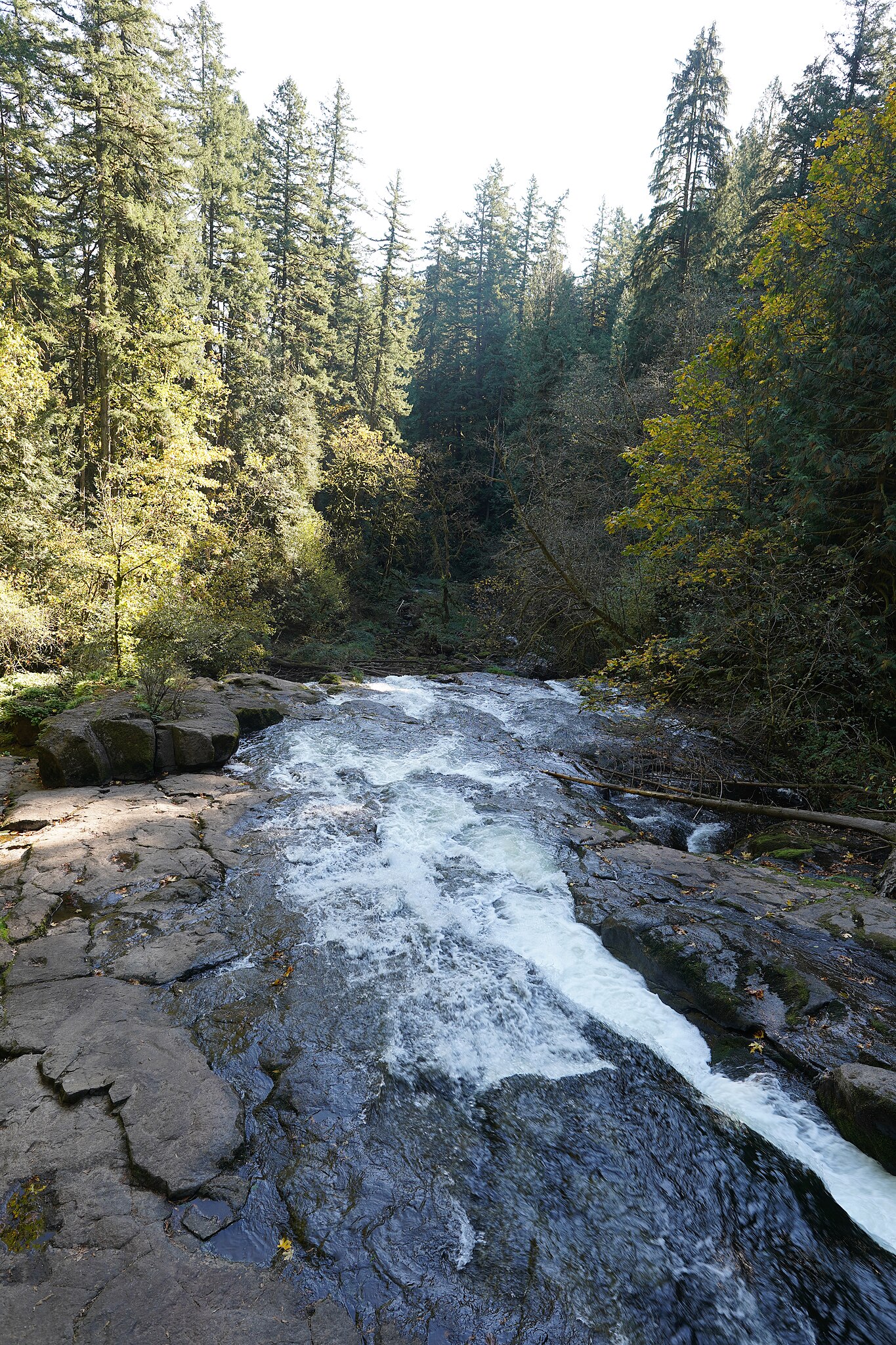
Moulton Falls Regional Park
Moulton Falls Regional Park, spanning an expansive 387 acres at the confluence of the East Fork of the Lewis River and Big Tree Creek, offers a stunning natural landscape with captivating features. The park, heavily forested and situated on both sides of the river, is home to two picturesque waterfalls and an impressive arch bridge standing over three stories high.
Nature enthusiasts can explore volcanic rock formations formed by ancient lava flows, uncover the historical significance of Indian meeting grounds, and traverse a swing bridge over Big Tree Creek. For those seeking more active pursuits, the park provides access to the 7.5-mile Bells Mountain Trail, inviting hikers to experience the beauty of the surrounding terrain.
Adding to the park’s charm, the Chelatchie Prairie Railroad excursion train passes through, providing a unique and scenic perspective. Moulton Falls Regional Park is a multifaceted destination, seamlessly blending natural beauty, historical elements, and recreational opportunities for visitors to enjoy.


78th Street Heritage Farm
The 78th Street Heritage Farm, with a rich history dating back nearly 150 years to the 1870s, holds a prominent place in the heritage of Clark County. Originally operating as a poor farm along the south side of Northeast 78th Street in Hazel Dell, the site evolved into a research and experimental farm under the management of Washington State University Extension. In 2008, Clark County resumed control of the property.
Spanning 79 acres adjacent to residential areas, the farm has a significant agricultural legacy, serving as a hub for farming and agricultural research throughout its history. Acknowledging its historical importance, the Heritage Farm was added to the Washington Historic Register in 2012 and further recognized on the National Register of Historic Places and the Clark County Historic Register in 2013.
The farm, located just west of Northeast 25th Avenue, is not only a historical landmark but also a community resource. Various community groups engage with the farm for projects and programs. However, individuals or organizations seeking to use portions of the Heritage Farm for ongoing initiatives or events are required to obtain prior approval, ensuring the preservation and responsible use of this significant piece of local history.
Lewis and Clark Regional Trail
The Lewis and Clark Regional Trail is a forthcoming project that promises to showcase the diverse and stunning landscapes of Clark County, Washington. Currently in the initial planning stages, this ambitious trail will span approximately 50 miles, offering an expansive and accessible route through the region’s natural beauty. The trail is set to commence at Stiegerwald Lake National Wildlife Refuge and will traverse westward along the Columbia River, passing through Vancouver’s new waterfront development, the Port of Vancouver, and extending into the rural areas of northern Clark County, ultimately concluding at Paradise Point State Park.
With a concept plan created through the assistance of a National Park Service technical grant award, the trail’s design is expected to be finalized by May 2020. The trail’s route roughly parallels the historic water route traveled by the Corps of Discovery, led by Meriwether Lewis and William Clark, over 200 years ago. Public Works, with guidance and support from the National Park Service, is collaborating with various stakeholders to plan this regional trail.
The Lewis and Clark Regional Trail will seamlessly integrate with existing waterfront trails and other city pathways, enhancing connectivity. The planning process includes considerations for parking areas, water access points, interpretive signage, historical art, and rest areas. Designed to accommodate a variety of modalities, including hikers, runners, cyclists, and equestrians, the trail aims to provide a diverse range of recreational opportunities. Beyond its recreational benefits, the trail is expected to foster community unity, strengthen regional partnerships, and stimulate the local economy by promoting tourism and supporting businesses along its path. From federal wildlife refuges to vibrant urban developments, the Lewis and Clark Regional Trail is poised to celebrate the natural wonders and rich history that define Clark County.
Geographic Features
Cascade Range
The Cascade Range, also known as the Cascades, is a significant mountain range in western North America, spanning from southern British Columbia through Washington and Oregon to Northern California. It encompasses non-volcanic mountains, like those in the North Cascades, as well as prominent volcanoes known as the High Cascades. In British Columbia, it is called the Canadian Cascades or locally referred to as the Cascade Mountains. Mount Rainier in Washington stands as the highest peak in the range, reaching an elevation of 14,411 feet (4,392 m).


Columbia River
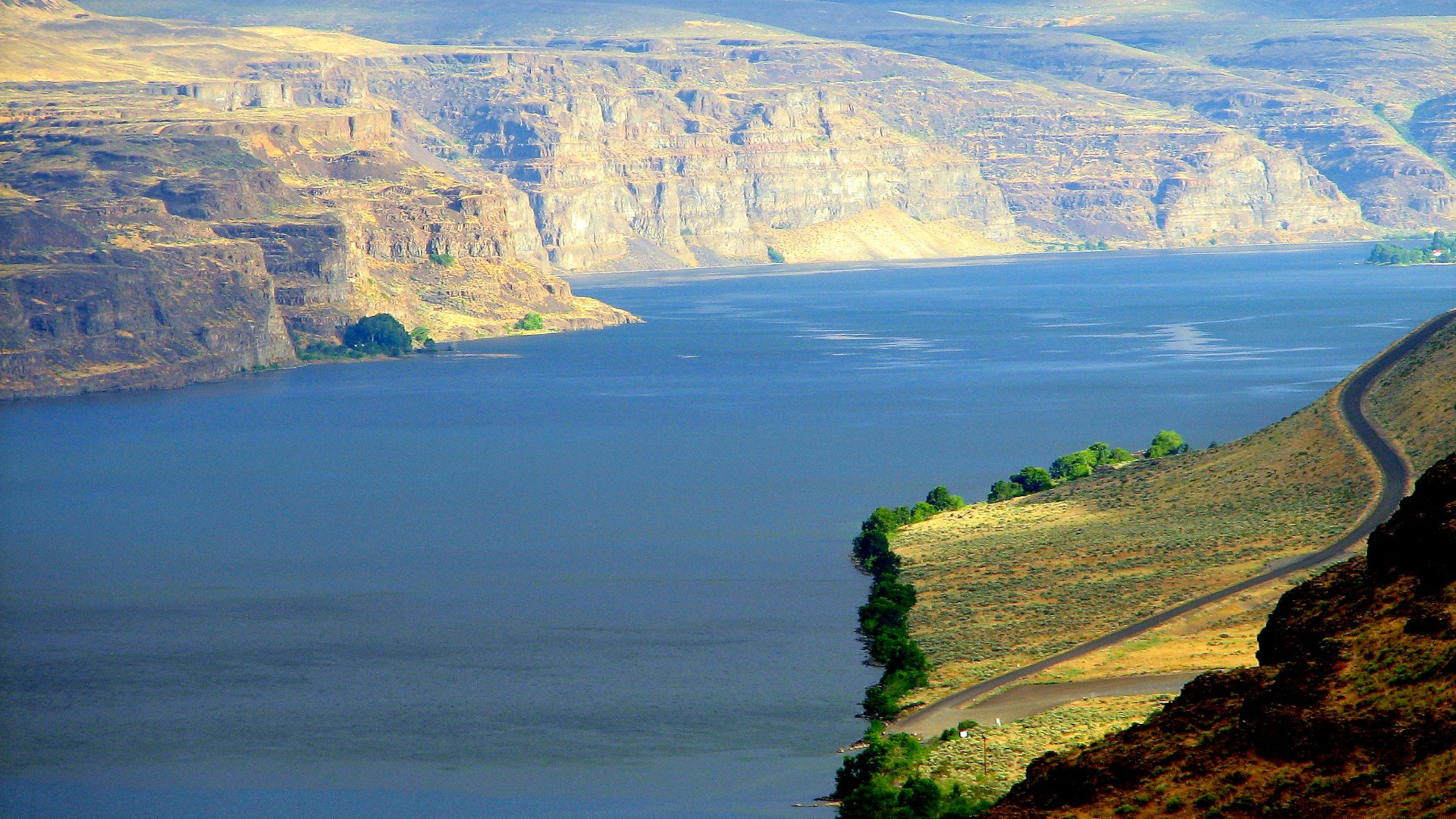
The Columbia River, known by various indigenous names such as Wimahl or Wimal in Upper Chinook and Nch’i-Wàna or Nchi wana in Sahaptin, stands as the largest river in the Pacific Northwest region of North America. Originating in the Rocky Mountains of British Columbia, Canada, the river flows northwest and then south into the state of Washington, subsequently turning west to create the majority of the border between Washington and Oregon before ultimately reaching the Pacific Ocean.
Stretching over an impressive 1,243 miles (2,000 kilometers), the Columbia River boasts a substantial drainage basin, roughly the size of France, and extends across seven U.S. states and one Canadian province. Noteworthy for being the fourth-largest river in the United States by volume, the Columbia River holds the distinction of having the greatest flow of any river entering the Pacific outside of Asia.
Additionally, it ranks 36th globally in terms of discharge, marking its significance as a major watercourse with ecological, economic, and geographical importance.


East Fork Lewis River
The East Fork Lewis River, a notable river in the state of Washington, serves as the largest tributary to the Lewis River. Originating on Green Lookout Mountain in Skamania County, it flows westward through Clark County until it meets the Lewis River approximately 3.5 miles (5.6 kilometers) upstream from the Columbia River.


Lacamas Creek
Lacamas Creek, situated in Clark County, Washington, spans approximately 12.5 miles from its headwaters near Camp Bonneville to Lacamas Lake and Round Lake in Camas, ultimately joining the Washougal River. The creek derives its name from the native camas plant. Fed by numerous streams, Lacamas Creek receives contributions from significant tributaries, including Matney Creek, Shanghai Creek, Fifth Plain Creek, China Ditch, and Dwyer Creek.
This watercourse is integral to the regional ecosystem, showcasing the interconnected nature of waterways in the area and their influence on the landscape.
Lacamas Lake
Lacamas Lake, located in Clark County, Washington, is a popular destination for fishing and water skiing among residents from Vancouver, Camas, and Washougal. The lake is connected to Round Lake through a channel beneath the SR 500 bridge on its southeast side.
In the 1990s, the surrounding area witnessed the emergence of high-tech manufacturing plants and upscale housing developments. While the lake is known for its warmth compared to other lakes in the region, it features a notable temperature drop with depth.
At its current state, this 60-foot-deep lake faces challenges supporting life below approximately 18 feet, resulting in what is referred to as a “Dead Zone.” Despite this ecological consideration, Lacamas Lake remains a popular recreational spot for the local community.
_-_panoramio.jpg\">Sam Beebe/Ecotrust</a>.")

Battle Ground Lake State Park
Battle Ground Lake State Park, spanning 280 acres and situated three miles northeast of Battle Ground, Washington, offers a picturesque public recreation area surrounded by an evergreen forest. The park features a volcanic crater lake and provides diverse recreational amenities, including a swimming area, boat launch, campground, and cabin rentals.
Hiking and bridle trails encircle the lake and traverse the summit area, offering outdoor enthusiasts various options for exploration. Anglers can enjoy fishing for rainbow trout and coastal cutthroat trout, stocked during the late winter through spring.
The lake also supports largemouth bass, grass carp, and crappie, with trout fishing being a highlight, particularly on opening day. Battle Ground Lake State Park stands as a scenic and multifaceted destination for outdoor activities and natural enjoyment.
Silver Star Mountain
Silver Star Mountain, a recently uplifted ridge within the Cascade Range in Washington, showcases a geologically diverse landscape. Comprising late Eocene to Oligocene epoch rock, including the prominent Silver Star Granodiorite unit, the mountain is located in the Gifford Pinchot National Forest. Despite its geological significance, the Silver Star Mountain area is lightly used for hiking.
Several trails traverse this picturesque terrain. The Silver Star trail, extending 5 miles, leads to an old roadbed west of Silver Star Mountain. The Silver Star Summit Trail #180D, covering 0.25 miles, culminates at the mountain’s summit. Additional trails like Indian Pits Trail #180E and Pyramid Rock Trail #180F branch off the Silver Star Trail to the south. Ed’s Trail #180A, named after pioneer Edward Robinson of the Chinook Trail Association, offers panoramic views of nearby volcanoes, including Mount St. Helens, Mount Rainier, Mount Adams, Mount Hood, and Mount Jefferson on clear days. Hailed by local hikers as one of the best hikes in Washington state, the Silver Star and Ed’s Trails collectively gain approximately 1,200 feet in elevation.
For those seeking views of the metropolitan area, Trail #172 Bluff Mountain provides glimpses of the Vancouver and Portland regions. With its geological intrigue, diverse trails, and stunning vistas, Silver Star Mountain offers a rewarding hiking experience within the natural beauty of the Pacific Northwest.


Green Mountain
Green Mountain, also known as “The Peak,” stands as the highest point and a stratovolcano on Ascension Island. This mountain has garnered attention for being the focal point of claims asserting it as one of the rare instances of a large-scale artificial forest. The name “Green Mountain” is commonly used to refer to this prominent feature on Ascension Island, highlighting both its geological significance and its role in environmental discussions related to afforestation efforts.


Lewisville Park
Lewisville Park, situated on the East Fork Lewis River in Clark County, Washington, spans 154 acres and serves as a significant regional park. Located two miles north of Battle Ground, it offers a variety of facilities for outdoor recreation.
These include a swimming hole (note: no lifeguard on duty), nature trails for exploration, playgrounds for children, a tennis/basketball court, and sports fields. The park also provides opportunities for fishing, enhancing its appeal as a comprehensive regional asset with diverse amenities for visitors to enjoy.


National Protected Areas
Fort Vancouver National Historic Site (Part)
Fort Vancouver National Historic Site, a distinguished United States National Historic Site spanning Washington and Oregon, consists of two units. One unit is situated on the grounds of Fort Vancouver in present-day Vancouver, Washington, while the other encompasses the former residence of John McLoughlin in Oregon City, Oregon. Both sites received individual national historic designations in the 1940s.
The visitor center at Fort Vancouver National Historic Site, originally constructed in 1966 as a part of the National Park Service’s Mission 66 Program, is now a collaborative effort between the National Park Service and the United States Forest Service. Recently renovated in 2015, the visitor center serves as an information hub for both Fort Vancouver National Historic Site and the Gifford Pinchot National Forest. Inside, visitors can explore rotating archaeological exhibits from the national historic site and art displays featuring local native artists.
The center includes a theater showcasing two films: “Oregon Experience: Fort Vancouver” (25 mins) and “Mount St. Helens – Eruption of Life” (17 mins), both produced by the National Park Service and the United States Forest Service. With its dual historical significance and commitment to education and cultural awareness, Fort Vancouver National Historic Site provides a comprehensive and engaging experience for visitors.


Gifford Pinchot National Forest (Part)
Gifford Pinchot National Forest, managed by the United States Forest Service, spans 1.32 million acres in southern Washington, stretching 116 km along the western slopes of the Cascade Range from Mount Rainier National Park to the Columbia River. This expansive forest encompasses diverse landscapes, including old-growth forests, high mountain meadows, glaciers, and volcanic peaks. The highest point, Mount Adams, rises to 12,276 ft, making it the second tallest volcano in the state.
Abbreviated as GPNF, the forest includes the Mount St. Helens National Volcanic Monument, established by Congress in 1982. Notable features within Gifford Pinchot National Forest comprise the Dark Divide Roadless Area, Silver Star Scenic Area, lava tubes, caves, and casts (including the Ice Caves and Ape Caves), Midway High Lakes Area, Big Lava Bed, Packwood Lake, Sawtooth Berry Fields (reserved for Yakima tribe use since 1932), Lone Butte Wildlife Emphasis Area, and Layser cave—an archeological site and former dwelling for Native Americans dating back 7,000 years. This vast and diverse forest offers a range of natural wonders and recreational opportunities for visitors to explore.


Ridgefield National Wildlife Refuge
Ridgefield National Wildlife Refuge, under the stewardship of the United States Fish and Wildlife Service, is a vital sanctuary located west of Ridgefield, Washington, along the Columbia River. This refuge, divided by Lake River, spans over 5,200 acres and encompasses marshes, grasslands, and woodlands, serving as a year-round habitat and migration stop for a diverse array of bird species.
The refuge is organized into several units, each with distinct management objectives. The Carty Unit focuses on conserving the natural Columbia River floodplain, offering a 2-mile self-guided hiking trail. The Roth and Ridgeport Dairy units also contribute to this preservation effort.
The River ‘S’ and Bachelor Island units are managed to optimize habitat for waterfowl and other wetland wildlife. The River ‘S’ Unit provides accessibility through a 4.2-mile auto tour route and the seasonal 1.2-mile Kiwa Hiking Trail. Additionally, a year-round path leads to a bird hide, enhancing opportunities for observation and appreciation of the diverse wildlife within the refuge. Ridgefield National Wildlife Refuge stands as a crucial haven for both resident and migratory bird populations, inviting visitors to connect with the natural beauty of the Columbia River landscape.


Steigerwald Lake National Wildlife Refuge
Steigerwald Lake National Wildlife Refuge, spanning 1,049 acres along the Columbia River, is a riverine floodplain habitat located 10 miles east of Vancouver, Washington. This refuge features a semi-permanent wetland characterized by cottonwood-dominated riparian corridors, pastures, and remnants of Oregon white oak stands. Notably, it represents the largest wetland restoration project on the lower Columbia River, involving the removal of approximately 2 miles of levees to restore 965 acres of floodplain habitat.
Situated partly within the Columbia River Gorge National Scenic Area, Steigerwald Lake National Wildlife Refuge also serves as the operational headquarters for the 329-acre Pierce National Wildlife Refuge. It has been designated as the site for the “Gateway to the Gorge” visitor center, completed in late 2022. This facility is anticipated to be frequented by as many as 100,000 visitors annually, providing a significant outreach opportunity in the Pacific Northwest. The refuge, with its commitment to habitat restoration and visitor engagement, plays a crucial role in preserving the natural beauty of the Columbia River region.
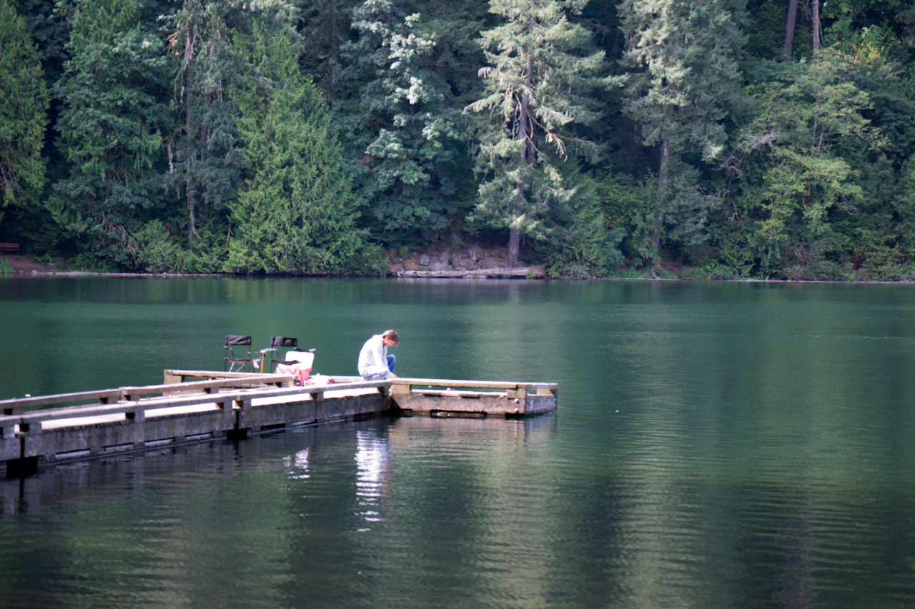
Clark County is surrounded on two sides by the Columbia River2https://www.flickr.com/photos/15363357@N00/189827699 and on the north by the North Fork of the Lewis River. It also has several park trails perfect for hiking and outdoor activities such as Bells Mountain, Captain William Clark Park at Cottonwood Beach, Chelatchie Prairie Rail with Trail, and many more.