Every year it seems for as long as I can remember property taxes have increased.
Did you know that doesn’t have to be the case?
In this article you’ll learn if you qualify to save hundreds if not thousands of dollars EVERY YEAR!!
For the rest of your life!
Grays Harbor County, Washington has tax relief programs for senior citizens and disabled persons.
If at the time of filing you are at least 61 years of age or disabled from regular gainful employment, have a total combined disposable income of $40,400 or less starting in 2024, own and occupy the residence as your principal residence at the time of filing, and reside in the home for more than 6 months each calendar year, you may qualify for a discount from all or part of your property tax on your residence in the county.
Schedule an appointment with us today if you want to take advantage of this benefit.
In Grays Harbor County, the first half tax amount is due April 30 and the second half tax amount is due October 31. Get this benefit ahead of the next due date. Schedule an appointment with our team today.
About Grays Harbor County
Grays Harbor County, located in the U.S. state of Washington, is characterized by a population of 75,636 as per the 2020 census1https://en.wikipedia.org/wiki/Grays_Harbor_County,_Washington. In 2010, the county recorded 72,797 residents, residing in 28,579 households and 18,493 families. With a population density of 38.3 inhabitants per square mile (14.8/km²), the county features diverse housing options, totaling 35,166 units at an average density of 18.5 units per square mile (7.1 units/km²). Grays Harbor County boasts a blend of residential and natural landscapes, reflecting its unique demographic and geographical characteristics.
Places You Can Visit
Humptulips River
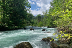
The Humptulips River, situated in Grays Harbor County, Washington, is a notable waterway with two main tributaries: the East Fork Humptulips River, spanning approximately 20 miles, and the West Fork Humptulips River, covering about 30 miles. Following their confluence, the main Humptulips River extends for approximately 20 miles.
According to the United States Geological Survey (USGS), the river has been known by variant names such as Hum-tu-lups, Humptolups, Humtutup, and Um-ta-lah. The river derives its name from the Humptulips Indians, a group within the Chehalis tribe. The origin of the name “Humptulips” is the subject of interpretation, with some sources suggesting it means “hard to pole” and others proposing it signifies a “chilly region.”
This river, with its diverse forks and cultural history, is an integral part of the geographical and historical tapestry of Grays Harbor County.
Hoquiam River
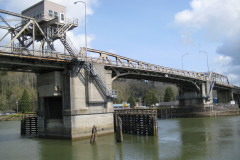
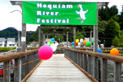
The Hoquiam River, located in the state of Washington, is a significant watercourse with three primary tributaries: the East Fork, West Fork, and Middle Fork Hoquiam Rivers. The main stem of the Hoquiam River is created by the merging of the West and East Forks, while the Middle Fork serves as a tributary to the West Fork.
The river’s name, derived from a Native American word, translates to “hungry for wood,” a reference to the substantial accumulation of driftwood at the river’s mouth. This characteristic, along with the intricate network of its tributaries, contributes to the ecological and cultural significance of the Hoquiam River in the region.
Lake Quinault
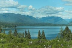
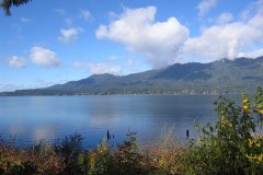
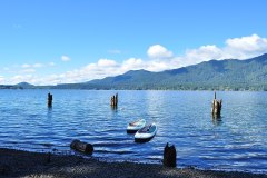
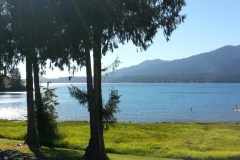
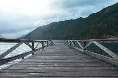
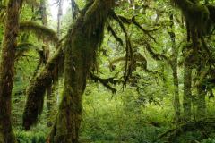
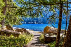
Lake Quinault, situated on the Olympic Peninsula in western Washington, is a captivating body of water nestled in the glacial-carved Quinault Valley of the Quinault River. Positioned at the southern edge of Olympic National Park, Lake Quinault is a notable feature within the Quinault Rainforest, renowned for its status as a temperate rainforest.
Owned by the Quinault Indian Nation, the lake is easily accessible from U.S. Route 101. Visitors can engage in various activities, including fishing with a permit from the Quinaults, scenic drives with a loop around the lake spanning over 30 miles, and hiking. The southern side of the lake boasts a network of short hiking trails maintained by the U.S. Forest Service, offering accessible options for casual day hikers.
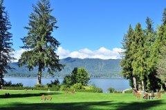
On the southern side, Lake Quinault is adorned with the historic Lake Quinault Lodge and the Rain Forest Resort Village, surrounded by the Olympic National Forest. The Quinault Loop Trail and the Quinault Rain Forest Interpretive Trail, both designated National Recreation Trails in 1979, provide excellent opportunities for exploring the temperate rainforest environment. The north side of the lake is characterized by private homes and small resorts within Olympic National Park.
Lake Quinault stands as a natural and recreational gem, inviting visitors to appreciate its scenic beauty and diverse outdoor activities.
Olympic Mountains
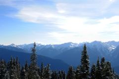
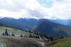
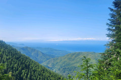
The Olympic Mountains, situated on the Olympic Peninsula in the Pacific Northwest of the United States, form a captivating mountain range within the Pacific Coast Ranges. While not exceptionally high, with Mount Olympus claiming the highest summit at 7,980 feet (2,432 meters), their dramatic presence is accentuated by the steep eastern slopes rising abruptly from sea level along Puget Sound. To the west, these mountains are separated from the Pacific Ocean by a low-lying 20 to 35 km (12 to 22 mi) wide coastal plain.
The western slopes of the Olympic Mountains are densely forested and hold the distinction of being the wettest place in the 48 contiguous states. This lush environment is part of the Olympic National Park, with adjoining segments protected within the Olympic National Forest. The protected status of these areas ensures the preservation of the diverse ecosystems, stunning landscapes, and unique climatic characteristics that define the Olympic Mountains, making them a notable natural wonder within the region.
Olympic Peninsula
The Olympic Peninsula, a sprawling landmass in western Washington, is a prominent geographical feature situated across Puget Sound from Seattle. Home to the renowned Olympic National Park, this peninsula is surrounded by the Pacific Ocean to the west, the Strait of Juan de Fuca to the north, and Hood Canal to the east. It encompasses approximately 3,600 square miles (9,300 km²) and has notable points such as Cape Alava, the westernmost point in the contiguous United States, and Cape Flattery, the northwesternmost point.
The Olympic Peninsula holds significance as one of the last unexplored areas in the contiguous United States, offering a diverse landscape and a wealth of natural treasures. The region hosts various state and national parks, including Anderson Lake, Bogachiel, Dosewallips, Fort Flagler, Fort Worden, Lake Cushman, Mystery Bay, Old Fort Townsend, Potlatch, Sequim Bay, Shine Tidelands, and Triton Cove state parks. The crown jewel of the peninsula is Olympic National Park, complemented by the Olympic National Forest, which includes designated wilderness areas like The Brothers, Buckhorn, Colonel Bob, Mt. Skokomish, and Wonder Mountain. Just off the west coast lies the Washington Islands Wilderness, enhancing the peninsula’s appeal for nature enthusiasts and preserving its pristine and unexplored landscapes.
Quinault River
The Quinault River, spanning a length of 69 miles (111 km), meanders through the picturesque landscapes of the Olympic Peninsula in Washington state. Originating deep within the Olympic Mountains within the Olympic National Park, the river embarks on a southwest journey through the captivating “Enchanted Valley” until it reaches Quinault Canyon. Notably, several miles upstream from Lake Quinault, the North Fork Quinault River joins the main stem, and this upper section is sometimes referred to as the East Fork Quinault River.
As it progresses downstream, the Quinault River delineates part of the boundary of Olympic National Park before eventually merging into Lake Quinault. Subsequently, the river continues its course southwestward, passing through the Quinault Indian Reservation and culminating in its convergence with the Pacific Ocean at Taholah. Notably, the entire stretch of the river from Lake Quinault to the ocean is contained within the Quinault Indian Reservation.
A well-maintained trail accompanies the East Fork of the Quinault, leading from Graves Creek to the Enchanted Valley Ranger Station, offering hikers the opportunity to traverse old-growth rainforests. Particularly in early summer, the valley becomes a spectacle of numerous waterfalls resulting from snowmelt, earning it the moniker “Valley of a Thousand Waterfalls.” The Quinault River, with its scenic beauty and ecological richness, stands as a notable natural feature on the Olympic Peninsula.
Quinault Rain Forest
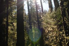
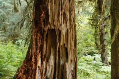
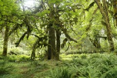
The Quinault Rain Forest, nestled within the Olympic National Park and the Olympic National Forest in Washington state, stands as a captivating example of a temperate rainforest. Encompassing the valley shaped by the Quinault River and Lake Quinault, this rainforest is often referred to as the “Valley of the Rain Forest Giants” due to the remarkable presence of record-size tree species.
Within the Quinault Rain Forest, nature enthusiasts encounter towering specimens of Western Red Cedar, Sitka Spruce, Western Hemlock, Alaskan Cedar, and Mountain Hemlock, with five of the ten largest Douglas-firs also gracing the forest. The region experiences an average annual rainfall of approximately 17 feet, making it one of the wettest places in the United States. Renowned for hosting the greatest number of record-size giant tree species in the world within a relatively small area, the Quinault Rain Forest is distinguished by its exceptional biodiversity.
As a popular tourist destination, the Quinault Rain Forest features a range of resorts and lodges on the shores of Lake Quinault, providing visitors with the opportunity to immerse themselves in the unparalleled beauty and ecological richness of this unique temperate rainforest. The area is celebrated for having the largest trees outside of California and New Zealand, making it a must-visit destination for those seeking a close encounter with the grandeur of nature.
Wishkah River
The Wishkah River, a tributary of the Chehalis River in Washington state, extends approximately 40 miles through a remote rural expanse covering about 102 square miles in Grays Harbor County. Situated along the Washington coast north of Aberdeen, the river flows southward through the county before converging with the Chehalis River at Aberdeen.
The name “Wishkah” is derived from the Chehalis word “hwish-kahl,” which translates to “stinking water.” Despite its name, the Wishkah River serves as a notable geographical feature in the region, contributing to the broader watershed and ecosystems within Grays Harbor County.

Griffiths-Priday State Park
Griffiths-Priday State Park, previously known as Griffiths-Priday Ocean State Park, is a 364-acre state-operated recreational area located at the mouth of the Copalis River on the Pacific Ocean in Grays Harbor County, Washington. The park offers a diverse landscape, featuring beach areas, low dunes, and a substantial stretch of ocean shoreline measuring 8,316 feet. Additionally, it provides 9,950 feet of freshwater river shoreline along both the Copalis River and the adjacent Connor Creek.
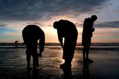
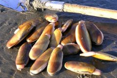
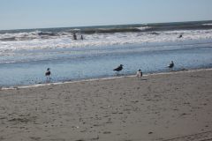
This park encompasses the Copalis Spit, a small peninsula that serves as a refuge for migratory birds, adding to its ecological significance. Visitors to Griffiths-Priday State Park can engage in various recreational activities, including picnicking, fishing, clam digging, beachcombing, birdwatching, mountain biking, and wildlife viewing, with migratory gray whales being a notable attraction. The park’s unique combination of coastal and riverine features makes it a versatile destination for nature enthusiasts and those seeking outdoor activities on the picturesque shores of the Pacific Ocean.

Lake Sylvia State Park
Lake Sylvia State Park, spanning 233 acres in the northern part of Montesano, Grays Harbor County, Washington, is a state-operated recreation area nestled within a dense temperate rainforest. Built around an old lumber mill pond, which once powered the town’s initial electrical generation plant, the park showcases a rustic dam at the western end of the lake.
Visitors to Lake Sylvia State Park can enjoy a range of recreational activities, including swimming, hiking, camping, fishing, and non-motorized boating. The park’s historical roots in the lumber industry add a distinctive touch, with remnants of the old mill pond infrastructure, including the dam, providing a glimpse into the region’s industrial past. Surrounded by the lush landscapes of a temperate rainforest, Lake Sylvia State Park invites nature enthusiasts and outdoor enthusiasts to experience the tranquility and natural beauty of the area.
Ocean City State Park
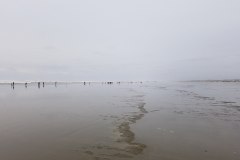
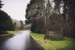
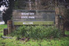
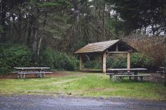
Ocean City State Park, situated approximately 2 miles north of downtown Ocean Shores in Grays Harbor County, Washington, is a state-operated recreational area on the Pacific Ocean. Encompassing 170 acres of beach, dunes, and lodgepole pine, the park provides a diverse range of activities for visitors.
Outdoor enthusiasts at Ocean City State Park can partake in various activities, including picnicking, camping, fishing, scuba diving, swimming, clam digging, crabbing, beachcombing, birdwatching, wildlife viewing, and engaging in interpretive programs. The park’s coastal location offers a picturesque setting for both relaxation and outdoor adventures, making it a versatile destination for individuals and families seeking a coastal getaway with a multitude of recreational options.
Pacific Beach State Park
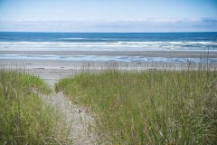
Pacific Beach State Park, located in Grays Harbor County, Washington, spans 17 acres along the Pacific Ocean, providing visitors with 2,300 feet of pristine beachfront. This state park offers a range of recreational activities, including picnicking, camping, fishing, swimming, clam digging, and beachcombing. With its scenic coastal setting and diverse array of activities, Pacific Beach State Park is an inviting destination for those seeking a coastal retreat and outdoor enjoyment on the shores of the Pacific Ocean.

Twin Harbors State Park
Twin Harbors State Park, situated two miles south of Westport in Grays Harbor County, Washington, encompasses 225 acres of coastal beauty along the Pacific Ocean. Once a U.S. Army training ground, the state began acquiring the site for park use in 1937, resulting in the establishment of Twin Harbors State Park.
Visitors to this public recreation area can enjoy a variety of outdoor activities, including camping, fishing, clamming, and beachcombing. The park also features a half-mile interpretive trail winding through a shoreline pine forest, providing opportunities for nature walks and exploration. With its coastal charm and diverse recreational offerings, Twin Harbors State Park stands as a welcoming destination for those seeking a coastal retreat in the scenic landscape of Grays Harbor County.
Westport Light State Park
Westport Light State Park, a public recreation area spanning 560 acres on the Pacific Ocean in Grays Harbor County, Washington, is adjacent to the historic Grays Harbor Light, the tallest lighthouse in the state. The park, which was expanded in 2016 to include the former Westhaven State Park and an additional 270-acre parcel originally intended for a golf course, offers a diverse range of outdoor activities.
Visitors to Westport Light State Park can engage in hiking, fishing, beachcombing, and birdwatching amid the coastal landscapes. The park’s proximity to the iconic Grays Harbor Light adds historical significance to the natural beauty, making it a compelling destination for those seeking a blend of outdoor recreation and cultural exploration on the picturesque shores of the Pacific Ocean.
Colonel Bob Wilderness
Colonel Bob Wilderness is a protected area spanning 11,855 acres in the southwest corner of Olympic National Forest, Washington. Named after 19th-century orator Robert Green Ingersoll, it features diverse elevations ranging from 300 to 4,509 feet above sea level, with the highest peak being an unnamed summit and the second-highest being Colonel Bob Mountain at 4,492 feet. Situated approximately 15 miles from Lake Quinault, the wilderness is accessible through over 12 miles of trails, including Colonel Bob Trail #851, Pete’s Creek Trail #858, and Fletcher Canyon Trail #857.
Activities such as backpacking, camping, hunting, and mountain climbing are popular in the area, and access is facilitated by South Shore Quinault Lake Road to the north or FS Road 2204 to the south.

Washington Maritime National Wildlife Refuge Complex
The Washington Maritime National Wildlife Refuge Complex is a collective management unit overseeing six National Wildlife Refuges in Washington, under the jurisdiction of the United States Fish and Wildlife Service. The included refuges are Flattery Rocks, Quillayute Needles, Copalis, Dungeness, Protection Island, and San Juan Islands.
Flattery Rocks, Quillayute Needles, and Copalis form a cluster of 870 islands, rocks, and reefs spanning over 100 miles along Washington’s coast from Cape Flattery to Copalis Beach. Designated as the Washington Islands Wilderness, these areas are safeguarded against human interference, providing proximity to abundant oceanic food sources. While closed to the public, wildlife observation is permitted from boats and the mainland, maintaining a 200-yard buffer zone around each island.
These islands serve as crucial habitats during migration seasons, hosting over a million seabirds, waterfowl, and shorebirds. Fourteen species of seabirds utilize the refuge for breeding colonies. Additionally, the surrounding waters are inhabited by various marine mammals, including sea lions, harbor seals, sea otters, and whales, contributing to the rich biodiversity of the region.

Grays Harbor National Wildlife Refuge
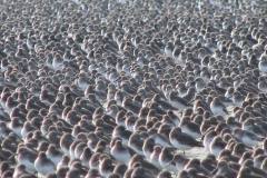
Grays Harbor National Wildlife Refuge, situated at the mouth of the Chehalis River within Grays Harbor, holds prominence as one of Washington’s key wildlife habitats. As part of the second largest watershed in the state, it plays a crucial role as one of the four major staging areas for migrating shorebirds in the Pacific Flyway.
During both spring and fall, the refuge becomes a vital resting and feeding ground, attracting an impressive congregation of up to one million shorebirds. This refuge serves as a critical waypoint for these migratory birds, contributing significantly to the ecological richness of the Pacific Northwest.
Olympic National Forest
Olympic National Forest, a U.S. National Forest in Washington, USA, encompasses a vast expanse of 628,115 acres, nearly encircling Olympic National Park and the Olympic Mountain range. Spanning parts of Clallam, Grays Harbor, Jefferson, and Mason counties, the forest features diverse landscapes, ranging from the lush, temperate Olympic rainforest to the saltwater fjord of Hood Canal and the towering peaks of Mt. Washington.
This expansive and varied terrain makes Olympic National Forest a remarkable natural area, offering a rich tapestry of ecosystems and outdoor experiences for visitors to explore.
Olympic National Park
Olympic National Park, located in Washington state on the Olympic Peninsula, is a diverse and expansive natural haven with four distinct regions: the Pacific coastline, alpine areas, the west-side temperate rainforest, and the forests of the drier east side. The park boasts three unique ecosystems, including subalpine forest and wildflower meadow, temperate forest, and the rugged Pacific coast.
While the park is crisscrossed by several roads, none delve deeply into the interior, emphasizing its wilderness character. A network of hiking trails offers access to the diverse landscapes, though venturing into the high country typically requires more than a weekend. The lush rainforest, with its vibrant greenery and numerous plant species, is a highlight, and despite the occasional rain, the months of July through September often provide extended dry periods.
Olympic National Park offers the distinctive opportunity for backpacking along its scenic coastline, allowing multi-day trips with entire days spent strolling along the beach. In winter, Hurricane Ridge provides a picturesque setting for winter sports, including skiing and snowboarding, with the Hurricane Ridge Ski and Snowboard Area catering to enthusiasts. The park’s extensive backcountry terrain is accessible for skiing and snowboarding when Hurricane Ridge Road is open.
Water activities abound, with rafting available on the Elwha and Hoh Rivers, and popular boating spots include Ozette Lake, Lake Crescent, and Lake Quinault. Fishing is permitted in various rivers, and although a license is not required within the park, certain regulations, such as the release of bull trout and Dolly Varden trout, apply.
For breathtaking views of Olympic National Park, the Hurricane Ridge viewpoint offers a splendid vantage point. The road leading west from the Hurricane Ridge visitor center provides access to picnic areas and trailheads, allowing visitors to immerse themselves in the natural beauty of this diverse and captivating national park.


