
Every year it seems for as long as I can remember property taxes have increased.
Did you know that doesn’t have to be the case?
In this article you’ll learn if you qualify to save hundreds if not thousands of dollars EVERY YEAR!!
For the rest of your life!
If you are a senior citizen or a disabled person, King County has tax relief programs for you.
If your annual income does not exceed $84,000 beginning in 2024 and you own and reside in your home, including mobile homes, you may be entitled to a property tax reduction. To qualify for this benefit, you must be either at least 62 years of age the first year you apply, retired because of a disability and unable to work, or a veteran with a service-connected evaluation of at least 80% total disability rating.
There are other factors that may affect your eligibility. If you want to know more, schedule an appointment with us today!
The amount of tax on your property will depend on the levy rate and the market value of your property. In 2023, the aggregate property taxes in King County reportedly rose by 6.4%.
The deadline for these taxes is on May 1 for the first half and on October 31 for the second half. You can pay either by mail, in person, or online. Payment by phone is not available as of this writing.
Before you pay these taxes, take advantage of the property tax reductions that may be available for you. Schedule an appointment with us today.
About King County
King County, situated in the U.S. state of Washington, is the most populous county in the state, having a population of 2,269,675 according to the 2020 census, making it the 13th-most populous county in the United States1https://en.wikipedia.org/wiki/King_County,_Washington. Originally named after U.S. representative William R. King in 1852, the county underwent a significant change in 1985. At that time, it amended its designation and logo to honor Martin Luther King Jr., a prominent civil rights activist renowned for his contributions during the Civil Rights Movement.
As of the 2010 census, King County was home to 1,931,249 people, residing in 789,232 households and 461,510 families. The county’s population density was 912.9 inhabitants per square mile (352.5/km2), reflecting a dynamic and diverse community. With 851,261 housing units at an average density of 402.4 per square mile (155.4/km2), King County stands as a vibrant and populous region within the state of Washington.
Places You Can Visit
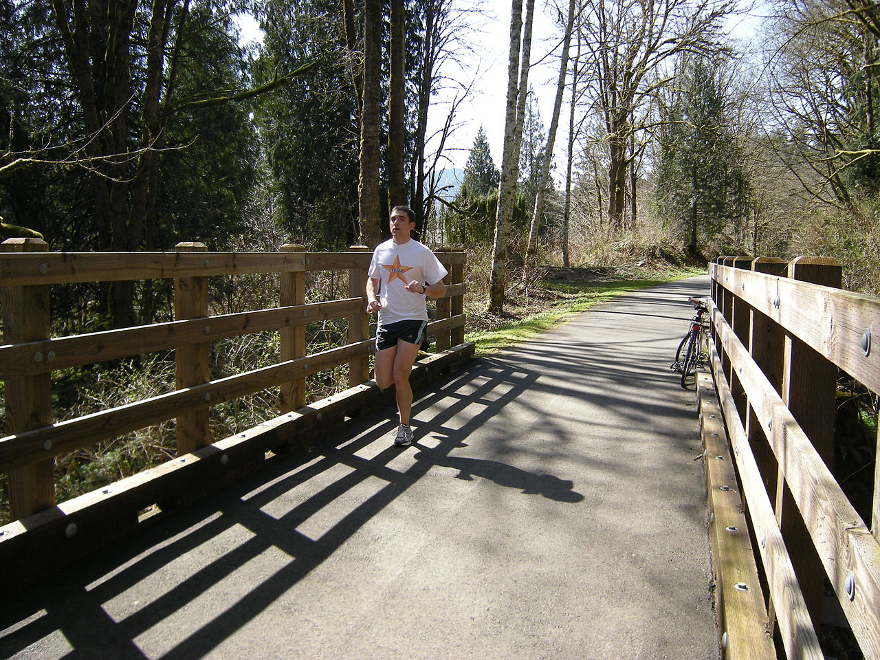
Burke-Gilman Trail
The Burke-Gilman Trail (BGT) spans over 20 miles, extending from Shilshole Bay in the City of Seattle to Bothell, where it intersects the Sammamish River Trail. Forming part of the “Locks to Lakes Corridor,” this paved, off-road facility offers a continuous trail experience, with the exception of an on-road segment in Ballard.
The trail winds through various neighborhoods, including Ballard, Fremont, Wallingford, the University District, and View Ridge within Seattle, as well as the cities of Lake Forest Park, Kenmore, and Bothell. Managed by Seattle within its city limits south of Northeast 145th Street and by King County outside Seattle, the BGT follows a historic railroad route adjacent to the Lake Washington Ship Canal and along Lake Washington to the Sammamish River.
Notable points of interest along the route include the Hiram Chittenden Locks, Fremont Canal Park, Gas Works Park, University of Washington, Magnuson Park, Log Boom Park in Kenmore, Wayne Golf Course in Bothell, and Blyth Park in Bothell. As one of King County’s most well-known regional trails, the BGT is immensely popular among cyclists, joggers, skaters, and pedestrians.
Beyond recreational use, it serves as a crucial nonmotorized route for weekday bicycle commuters between Seattle and the Eastside, offering picturesque views of the Ship Canal, Lake Union, Seattle neighborhoods, suburban cities, Lake Washington, and connecting to other regional trails.

East Lake Sammamish Trail
The East Lake Sammamish Trail (ELST) is an integral component of the Locks to Lakes Corridor, a substantial 44-mile regional trail corridor connecting key trails such as the Burke-Gilman Trail, Sammamish River Trail, Marymoor Connector Trail, and Issaquah-Preston Trail. This corridor seamlessly links Seattle to the Eastside and the Cascade Foothills, facilitating regional connectivity.
As part of the expansive Leafline Trails Network, encompassing over 500 miles of paved, non-motorized trails across four counties, the ELST and Locks to Lakes Corridor contribute significantly to regional accessibility. Designed for a range of users, including bicyclists, pedestrians, joggers, walkers, and individuals of all ages and abilities, these trails enhance access to recreational areas, employment centers, and retail spaces.
The East Lake Sammamish Trail stands as a crucial element in a broader network, providing a multi-use path that promotes active transportation and outdoor enjoyment within the scenic landscapes of the Pacific Northwest.
Green River Trail Site
The Green River Trail (GRT) stretches over 19 miles, beginning at Cecil Moses Park near Seattle’s southern boundary and concluding at North Green River Park in south Kent near Auburn.
Following the course of the Green River, the trail navigates through industrial areas near the Duwamish Waterway in Tukwila before opening up to the expansive Green River Valley. Paved along its entire length, with occasional low-volume roadway segments, the GRT offers captivating views and direct access to the Green River and its surrounding valley.
Heading north, the trail passes through a mix of riverside landscapes, industrial zones, and well-manicured office parks. It intersects with the northern end of the Interurban Trail near Fort Dent Park before meandering south through diverse environments.
As it progresses, the trail transitions from office buildings and suburban warehouses to open fields and hedgerows, ultimately entering Kent near Brisco Park. Continuing past the Green River Valley Natural Resources Area and the Riverbend Golf Complex, the GRT showcases a variety of landscapes.
This trail seamlessly connects industrial areas with pastoral settings, parks, communities, and scenic river views. A favorite among various user groups for recreational activities and nonmotorized commuting, the GRT is poised for future expansion.
Planned extensions include continuing south through the City of Auburn and reaching Flaming Geyser State Park at the Green River Gorge, promising even more exploration opportunities along this vibrant trail.

Middle Fork Snoqualmie Natural Area
The Middle Fork Snoqualmie Natural Area, positioned approximately nine miles east of the City of North Bend along the Middle Fork of the Snoqualmie River, boasts a predominantly forested landscape along the river and its tributary streams. This natural area serves as vital habitat for a diverse range of terrestrial and aquatic wildlife, contributing to the region’s ecological richness.
Situated in proximity to US Forest Service lands and the Mount Si Recreation Area, the Middle Fork Snoqualmie Natural Area provides opportunities for outdoor recreation and exploration. Additionally, the park is conveniently located across SE Lake Dorothy Rd from a hand boat river access point, facilitating easy access for kayaks, rafts, and canoes.
With its scenic beauty and ecological significance, this natural area offers a retreat into the Pacific Northwest’s natural splendor.

Preston Snoqualmie Trail
The Preston-Snoqualmie Trail is a picturesque paved pathway that traverses steep terrain within the Mountains to Sound Greenway. Commencing from either the Preston Athletic Fields and Community Park or the Lake Alice parking lot, this trail offers a captivating journey through the region’s mountainous landscape.
Winding from west to east, the trail meanders alongside lush green hills adorned with ferns, towering cedars, spruce, and other evergreen trees. After crossing Preston-Fall City Road Southeast, the trail takes a unique route, traversing the Raging River and navigating steep, tight switchbacks that replace the historical trestle over the river and road.
Heading eastward from the Lake Alice parking lot retraces the trail’s historic railroad route, featuring gentle grades suitable for walking, running, and bicycling. Enveloped by moss-covered trees and subtle dips, the trail provides a serene experience.
During the fall, when the trees shed their leaves, the eastern end of the trail reveals glimpses of the magnificent Snoqualmie Falls, adding a breathtaking element to this scenic and historically rich route.
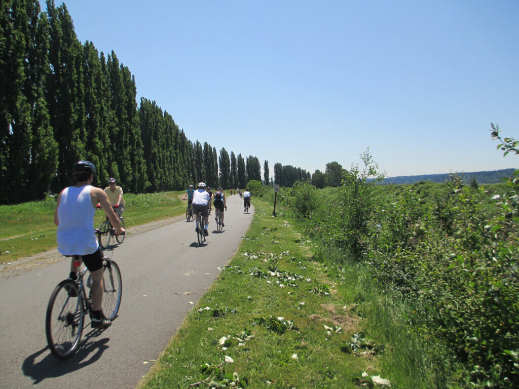
Sammamish River Trail
The Sammamish River Trail (SRT) is a scenic 10.1-mile paved pathway tracing the course of the Sammamish River, connecting Bothell to Marymoor Park in Redmond as a key component of the “Locks to Lakes Corridor.”
Renowned as one of King County’s premier regional trails, the SRT provides a popular recreational route for cyclists, joggers, skaters, walkers, and outdoor enthusiasts. Paved across its entire length, the trail showcases stunning vistas of the meandering river, the expansive Sammamish River Valley, the Cascade foothills, and the majestic Mount Rainier.
This trail stands out as a cherished regional resource, offering an immersive and enjoyable experience amid the natural beauty of the Pacific Northwest.
Snoqualmie Valley Trail
The Snoqualmie Valley Trail provides a delightful opportunity to explore one of the most picturesque agricultural valleys in the region. Just 30 minutes from bustling urban centers, this trail invites visitors to soak in the scenic beauty of family farmsteads, the North Fork Snoqualmie River, and a diverse array of wildlife.
Winding its way through working farmland and preserved open spaces, the trail is a gateway to the cross-state Palouse to Cascades Trail in Iron Horse State Park, extending across the length of Washington State. Noteworthy points of interest along the Snoqualmie Valley Trail include Tolt-MacDonald Park, Meadowbrook Farm, Three Forks Natural Area, and the iconic Tokul Trestle.
Whether you’re seeking a peaceful stroll or a longer adventure, this trail offers a unique and immersive experience in a tranquil natural setting.
Cascade Range
The Cascade Range, commonly known as the Cascades, stands as a significant mountain range in western North America, stretching from southern British Columbia through Washington and Oregon to Northern California. This expansive range encompasses non-volcanic mountains, exemplified by the North Cascades, as well as the renowned volcanoes recognized as the High Cascades.
In British Columbia, this mountainous region is referred to as the Canadian Cascades or the Cascade Mountains locally. Mount Rainier in Washington, towering at 14,411 feet (4,392 m), claims the title of the highest peak within the Cascade Range.


Issaquah Alps
The Issaquah Alps, an informal designation, encompass the elevated terrains surrounding Issaquah, Washington, a suburban area near Seattle. This scenic expanse includes prominent features such as Cougar Mountain, Squak Mountain, Tiger Mountain, Taylor Mountain, Rattlesnake Ridge, Rattlesnake Mountain, and Grand Ridge.
These interconnected mountainous areas collectively form the Issaquah Alps, offering a diverse range of outdoor activities and serving as a popular destination for nature enthusiasts and hikers.

Mount Baker–Snoqualmie National Forest
The Mount Baker–Snoqualmie National Forest, situated in Washington, is a vast expanse of more than 140 miles along the western slopes of the Cascade Range. Stretching from the Canada–US border to the northern boundary of Mount Rainier National Park, this National Forest is under the administration of the United States Forest Service, with its headquarters located in Everett.
The forest encompasses diverse landscapes and ecosystems and is home to local ranger district offices in North Bend and Skykomish, facilitating the management and preservation of this expansive natural area.


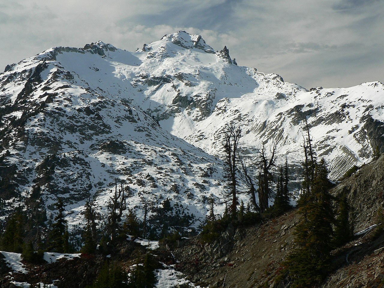
Mount Daniel
Mount Daniel stands as the tallest peak on the Cascade Range crest within the Alpine Lakes Wilderness of central Washington, USA. This prominent summit holds the distinction of being the highest point in both King and Kittitas counties.
Not only does Mount Daniel command breathtaking views, but the streams flowing down its eastern slopes also contribute to the headwaters of the Cle Elum River, further enhancing its ecological significance in the region.
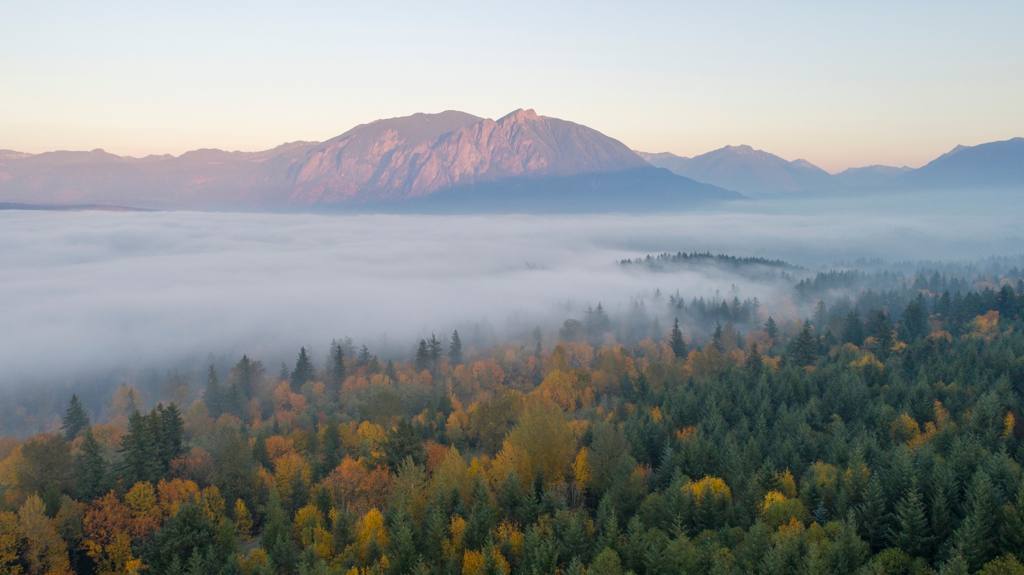
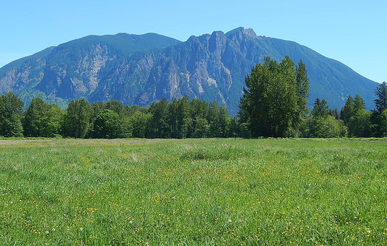
Mount Si
Mount Si, situated to the east of Seattle, Washington, stands as a prominent peak on the western edge of the Cascade Range, overlooking the coastal plains surrounding Puget Sound. Dominating the landscape above the town of North Bend, Mount Si and its companion peak, Little Si, were named in honor of local homesteader Josiah “Uncle Si” Merritt. The mountain gained national recognition in the early 1990s as the backdrop for the television series Twin Peaks, which was filmed in the nearby town of North Bend.
A mere 45-minute drive from Seattle, Mount Si is a popular outdoor destination for Puget Sound residents. The mountain attracts between 80,000 and 100,000 hikers annually, offering a rewarding and accessible experience for those seeking adventure in the natural beauty of the Pacific Northwest.

Harbor Island
Harbor Island, situated at the mouth of the Duwamish River in Seattle, Washington, is an artificial island with a rich industrial history. Constructed by the Puget Sound Bridge and Dredging Company, the island’s completion in 1909 marked it as the world’s largest artificial island at the time, spanning 350 acres (1.4 km2).
Since 1912, Harbor Island has served as a hub for various commercial and industrial activities, including secondary lead smelting, shipbuilding and repair, bulk petroleum storage, metal fabrication, and containerized cargo shipping.
The island hosts warehouses, laboratories, and other structures dedicated to supporting its diverse industrial functions.

Maury Island
Maury Island, a tied island in Puget Sound, Washington, is linked to Vashon Island by an isthmus constructed by local homeowners in 1913. Prior to the isthmus’s creation, the island was accessible only during low tide.
Rural in nature, Maury Island boasts expansive areas of farmland, forest, and relatively undeveloped shoreline. Named during the Wilkes Expedition in 1841 in honor of William Lewis Maury, the island gained historical significance as the site of the Maury Island incident, an alleged encounter with a UFO.

Mercer Island
Mercer Island, situated in the southern part of Lake Washington, is a city in King County, Washington. Positioned within the Seattle metropolitan area, it is flanked by Seattle to the west and Bellevue to the east.
Connected to the mainland by the Lacey V. Murrow Memorial Bridge and the Homer M. Hadley Memorial Bridge, both of which carry Interstate 90, Mercer Island enjoys proximity to both Seattle and Bellevue.
The city is often associated with King County’s Eastside due to its closer proximity to Bellevue than Seattle.

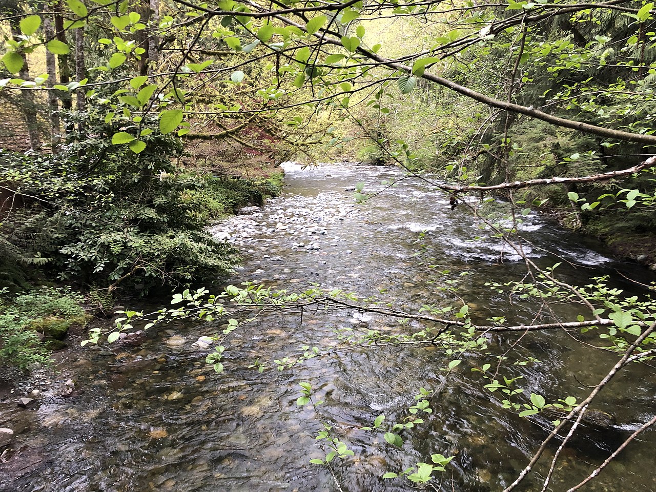
Cedar River
The Cedar River, a river in the state of Washington, spans approximately 45 miles, originating in the Cascade Range. It flows in a west and northwest direction, ultimately emptying into the southern part of Lake Washington.
The upper watershed of the Cedar River is known as the Cedar River Watershed, serving as a protected area that supplies drinking water for the greater Seattle area. The river eventually drains into Puget Sound through Lake Washington and the Lake Washington Ship Canal.

Duwamish River
The Duwamish River constitutes the lower 12 miles of Washington state’s Green River, forming an industrialized estuary known as the Duwamish Waterway. In 2009, the Duwamish Longhouse and Cultural Center was established on the river’s west bank, symbolizing the tribe’s efforts to reclaim historical rights and seek federal recognition.
The Port of Seattle possesses numerous properties along the Duwamish River and its industrial channels. In 2020, six parks along the river were renamed with indigenous Lushootseed names following consultation with local tribes.

Elliott Bay
Elliott Bay, situated within the Central Basin region of Puget Sound in the U.S. state of Washington, stretches southeastward between West Point in the north and Alki Point in the south. The city of Seattle was established on the shores of Elliott Bay in the 1850s, evolving to encompass the bay entirely.

Greenwater River
The Greenwater River, located in the U.S. state of Washington, flows through a watershed that drains a section of the Cascade Range east and northeast of Mount Rainier, encompassing parts of the Norse Peak Wilderness. This river converges with the White River at Greenwater, contributing to the larger drainage system that eventually reaches Puget Sound via the Puyallup River.

Issaquah Creek
Issaquah Creek, a small stream in the U.S. state of Washington, meanders through the city of Issaquah and neighboring communities. Originating from the slopes of Cougar, Squak, Tiger, and Taylor mountains in the Issaquah Alps, the creek is fed by various tributaries, including Holder Creek, Carey Creek, Fifteen-mile Creek, McDonald Creek, East Fork Issaquah Creek, and North Fork Issaquah Creek. Its journey concludes as it empties into the southern tip of Lake Sammamish.
The lake’s outlet is the Sammamish River, which further leads to Lake Washington and eventually Puget Sound.

Lake Sammamish
Lake Sammamish, situated 8 miles east of Seattle in King County, Washington, is a freshwater lake boasting dimensions of 7 miles in length, 1.5 miles in width, a maximum depth of 105 feet, and a surface area of 8 square miles. Nestled between Lake Washington to the west and the Sammamish Plateau to the east, the lake spans from Issaquah in the south to Redmond in the north. Fed by Issaquah Creek at its southern point and draining into Lake Washington via the Sammamish River at its northern end, the lake is rich in recreational opportunities.
Notable locations surrounding Lake Sammamish include Marymoor Park to the north, Lake Sammamish State Park to the south, and the East Lake Sammamish Trail. Lake Sammamish State Park features nine public boat launches with separate entrances for a fee, offering convenient access, parking, and restroom facilities. Redmond’s Idylwood Park provides public access to the lake’s west shores, while Vasa Park Resort in Bellevue caters to westward entry for a fee, including a ramp for watercraft.
Popular activities on Lake Sammamish encompass rowing, fishing, waterskiing, wakeboarding, wakesurfing, tubing, and jet skiing. A public slalom course for waterskiing is available at the lake’s far north end. Fishing enthusiasts can indulge in pursuing various species like perch, smallmouth bass, largemouth bass, cutthroat trout, salmon, and steelhead trout.

Lake Union
Lake Union, a freshwater lake entirely within Seattle’s city limits in Washington, is a prominent feature of the Lake Washington Ship Canal, connecting Lake Washington to Puget Sound. The Ship Canal Bridge marks the easternmost point, separating Lake Union from Portage Bay. Neighborhoods like Eastlake, Westlake, and South Lake Union derive their names from the lake. Popular destinations on its shores include Lake Union Park, the Museum of History & Industry (MOHAI), the Center for Wooden Boats, and Gas Works Park.
Lake Union’s scenic views of Seattle and the University District, coupled with its central location, make it a favored recreational spot. The lake hosts seaplane operations by Kenmore Air and Seattle Seaplanes, with pleasure boats transitioning from Lake Washington to Puget Sound. The Center for Wooden Boats organizes an annual wooden boat festival, and the Seattle Boat Show showcases watercraft on the lake. The Duck Dodge sailboat races and various water activities, such as rowing, paddleboarding, and kayaking, contribute to the lake’s vibrant atmosphere.
Gas Works Park, the largest park on Lake Union, hosts summer concerts and Seattle’s major Fourth of July fireworks display. Other surrounding parks include North Passage Point Park, South Passage Point Park, Fairview Park, Terry Pettus Park, and South Lake Union Park. Notable features of Lake Union include floating homes, famously depicted in the movie “Sleepless in Seattle.”

Lake Washington
Lake Washington, a substantial freshwater lake in proximity to Seattle, Washington, stands as King County’s largest lake and the second largest natural lake in the state, following Lake Chelan. Its shores touch Seattle to the west, while Bellevue and Kirkland lie on the east, Renton to the south, and Kenmore to the north. Mercer Island is encompassed within the lake’s waters.
The lake’s northern end is fed by the Sammamish River, while the Cedar River contributes to its southern end. Known for its scenic beauty and central location, Lake Washington plays a pivotal role in the region’s geography and recreational activities.

Puget Sound
Puget Sound, a distinctive feature of the Pacific Northwest, stands as an inlet of the Pacific Ocean and a vital component of the Salish Sea. Nestled along the northwestern coast of Washington state, Puget Sound boasts a complex estuarine system characterized by interconnected marine waterways and basins. It maintains significant connections to the open Pacific Ocean through Admiralty Inlet, the principal link, and Deception Pass and Swinomish Channel, the secondary connections. Renowned for its scenic beauty and ecological diversity, Puget Sound plays a crucial role in the region’s maritime environment.

Raging River
The Raging River, a tributary of the Snoqualmie River in western Washington state, flows through the western foothills of the Cascade Mountains in east central King County. Its name reflects the river’s capacity, with a record discharge exceeding 4,000 cubic feet per second. Renowned for its salmon-bearing qualities, the Raging River contributes significantly to the Snoqualmie River’s chinook runs.
The Preston-Snoqualmie Trail, accommodating biking and dogs, traces a 3½-mile path along the Raging River and Preston-Fall City Road, extending towards Snoqualmie Falls. The lower section of the Raging River, spanning from Preston to Fall City, offers a challenging kayaking experience, rated as class III+ (difficult) over its 5-mile length.
Skykomish River
The Skykomish River, stretching 29 miles through the U.S. state of Washington, serves as a vital watercourse draining the western slopes of the Cascade Mountains in Snohomish and King Counties. Originating from the convergence of the North Fork Skykomish River and South Fork Skykomish River near Index, the river flows northwesterly toward Puget Sound.
Renowned for its recreational opportunities, the Skykomish River attracts enthusiasts of rafting and kayaking, particularly in the Index, WA area, offering Class III to Class III+ rapids with notable features like Boulder Drop, a Class IV+ rapid. Additionally, the river and its tributaries are popular for recreational fishing, providing a habitat for chinook, coho, pink salmon, steelhead, and bull trout.

Snoqualmie Falls
Snoqualmie Falls, a majestic 268-foot (82 m) waterfall situated east of Seattle on the Snoqualmie River between Snoqualmie and Fall City, Washington, stands as one of the state’s premier scenic attractions. Renowned internationally for its captivating beauty and featured in the television series Twin Peaks, Snoqualmie Falls draws over 1.5 million visitors annually.
The site offers a two-acre park, complete with an observation deck and a gift shop, where guests can experience the falls from a vantage point less than 100 yards from the parking lot. The area features picnic tables, benches, and the Centennial Green, a small meadow hosting summer weddings.

Snoqualmie River
The Snoqualmie River, stretching 45 miles through King County and Snohomish County in Washington, is a scenic waterway formed by its main tributaries: the North, Middle, and South Forks. Originating from the west side of the Cascade Mountains near North Bend, these forks converge above the iconic Snoqualmie Falls. Flowing northwards through fertile farmland, the river passes Fall City, Carnation, and Duvall before merging with the Skykomish River, ultimately forming the Snohomish River near Monroe.
Key tributaries include the Taylor and Pratt Rivers, the Tolt River, and the Raging River. The Snoqualmie River offers diverse sections suitable for whitewater activities, ranging from Class II to Class V+. Kayaking and rafting enthusiasts can explore its rapids, while the river’s picturesque journey culminates in its convergence with the Snohomish River, which eventually reaches Puget Sound at Everett.

Tolt River
The Tolt River, situated in the western foothills of the Cascade Mountains in north-central King County, Washington, is formed by the merging waters of the North Fork Tolt and South Fork Tolt rivers. Flowing in a southwest direction, it eventually meets the Snoqualmie River near the town of Carnation.
As a contributing watershed to the Snohomish River and Puget Sound drainage basin, the Tolt River plays a role in the larger regional hydrological network.

Klondike Gold Rush National Historical Park
Klondike Gold Rush National Historical Park, administered by the National Park Service, is dedicated to preserving and commemorating the significant events of the late 1890s Klondike Gold Rush. While the ultimate destination for gold seekers was the Yukon Territory, the park encompasses staging areas and routes leading to the gold fields.
With four units, including three located in the Municipality of Skagway Borough, Alaska, and the fourth situated in Seattle, Washington’s Pioneer Square National Historic District, the park offers insights into the challenges and adventures faced by those pursuing fortunes in the Klondike region.

Mount Baker–Snoqualmie National Forest
Mount Baker–Snoqualmie National Forest, stretching over 140 miles along the western slopes of the Cascade Range in Washington, is a vast National Forest that extends from the Canada–US border to the northern boundary of Mount Rainier National Park. Under the administration of the United States Forest Service, the forest’s headquarters is located in Everett.
Offering a diverse range of ecosystems and recreational opportunities, this expansive forest is a significant natural resource managed for the benefit of the public and the preservation of its unique landscapes.