
Every year it seems for as long as I can remember property taxes have increased.
Did you know that doesn’t have to be the case?
In this article you’ll learn if you qualify to save hundreds if not thousands of dollars EVERY YEAR!!
For the rest of your life!
Lewis County gives senior citizens and disabled persons discounts on their property taxes, provided that they qualify for this benefit.
By December 31 of the assessment year, if you are either at least 61 years of age, unable to work because of a disability, or a disabled veteran with a service-connected evaluation of at least 80% or receiving compensation from the United States Department of Veterans Affairs at the 100% rate for a service-connected disability, you may be entitled to a deduction on your property taxes.
Additionally, your household income should not exceed $48,000 beginning in 2024. You must also own and occupy your home.
If you think you qualify for the county’s tax relief program, schedule an appointment with us today and we will help you get this benefit fast.
Lewis County’s average effective property tax rate is 1.01%. While you can pay in person or by mail, the county allows you to pay your taxes online, using a debit card, credit card, or E-check through their Point & Pay online service. But there are additional fees to use this service:
- All Credit Cards- 2.25%
- Debit Cards- $3.50 (tax payments only)
- E-check- $0.90
You can reduce your payment of property taxes. Take advantage of the county’s tax relief programs. Schedule an appointment with us today.
About Lewis County
Lewis County, situated in Washington, had a population of 82,149 according to the 2020 census. As of the 2010 Census, the county recorded 75,455 residents, with 29,743 households and 20,104 families. The population density was 31.4 people per square mile (12.1 people/km²), and the county had 34,050 housing units at an average density of 14.2 units per square mile (5.5 units/km²).
Places You Can Visit
Box Canyon
Box Canyon, situated along Stevens Canyon Road, is accessible to vehicles exclusively during the summer season, typically from June to September. This narrow slot canyon, carved by the Muddy Fork of the Cowlitz River, offers a picturesque setting with various amenities. The developed area features an overlook, comfort station, picnic area, and a short loop trail.
The Box Canyon Bridge, constructed between 1950-1952 in the National Park Service rustic style, spans 160 feet and is approximately 41 feet wide, showcasing a veneer of native granite. From the lower Box Canyon Overlook, visitors can enjoy a stunning view of the bridge, facing northwest towards Mount Rainier.
The Box Canyon Loop Trail is a notable feature that connects to the Wonderland Trail. This trail intersects with Stevens Canyon Road, either crossing over the top of the road tunnel when heading northwest or ascending towards Indian Bar if heading northeast. The southern vantage point provides views of the canyon and the distant Cascades, while looking north reveals Mount Rainier on clear days. Visitors can also peer down to witness the river rushing far below, completing the scenic experience at Box Canyon.

Burley Mountain Fire Lookout
The Burley Mountain Fire Lookout, erected in 1934 at an elevation of approximately 5,100 feet, provides a commanding view over extensive stretches of the Gifford Pinchot National Forest. Originally constructed for fire detection, the lookout is still occasionally utilized for this purpose during the summer season. Additionally, it is open for overnight rentals, attracting backpackers, hikers, mountain bikers, and other outdoor enthusiasts.
Perched atop Burley Mountain, the lookout offers a breathtaking panorama, allowing visitors to gaze upon numerous Cascade peaks on clear, sunny days. Accessible via Forest Road 23 to Cispus Road, with clear signage guiding the way, the journey is recommended for high-profile vehicles, and four-wheel drive is advisable to navigate the terrain. Whether for fire monitoring or recreational purposes, the Burley Mountain Fire Lookout stands as both a historic structure and a scenic destination within the Gifford Pinchot National Forest.

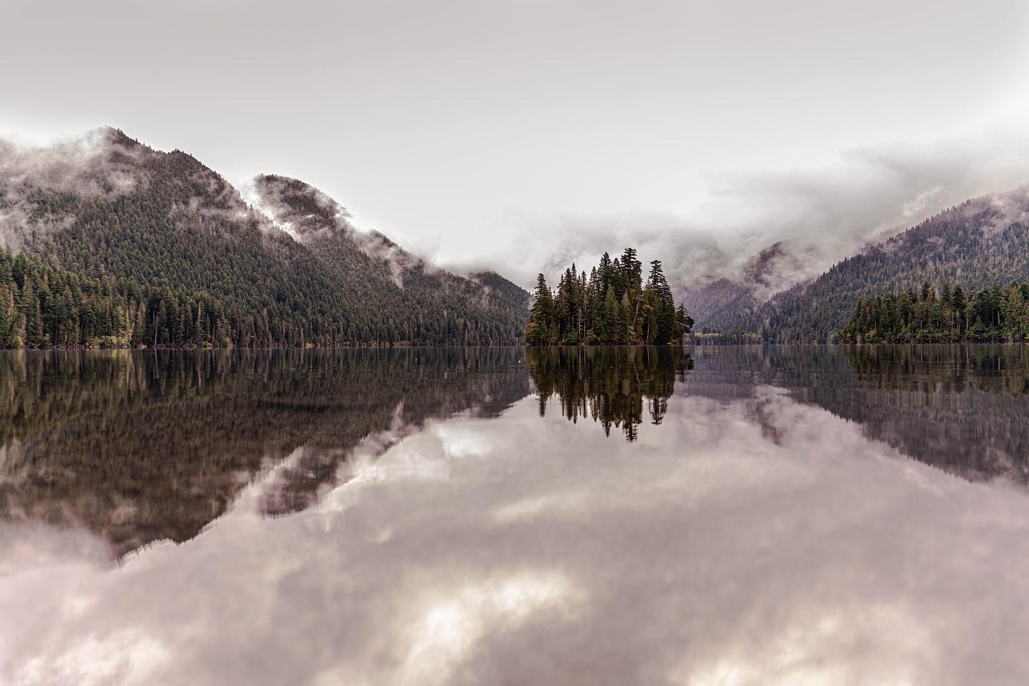
Carlisle Lake
Originally a mill pond, Carlisle Lake and its surrounding area have undergone a transformation, now serving as a thriving salmon habitat and a sanctuary for local birdwatchers. The creation of a new nature trail adds to the appeal, making it Onalaska’s latest attraction.
The trail, encircling the lake, offers a pleasant compact gravel surface, inviting walkers and joggers to explore the natural beauty of the area. Carlisle Lake stands as a testament to the successful blending of environmental conservation, recreational opportunities, and the enjoyment of local wildlife.

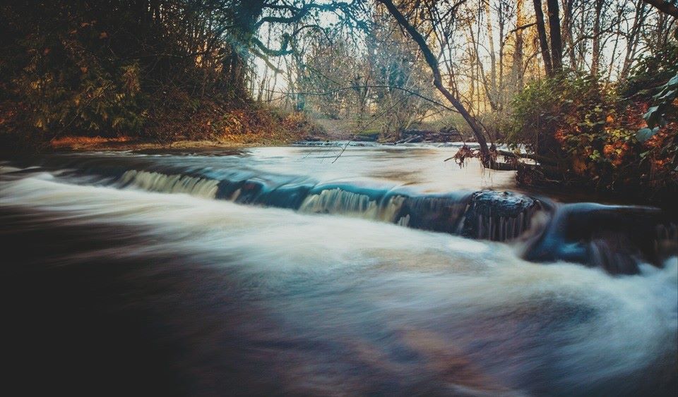
Chehalis River
The Chehalis River, renowned for painting the surrounding fields in a vibrant shade of green, notably graces the Boistfort Valley and other agriculture-rich regions. In the Doty area, the river hosts Rainbow Falls, a small yet gently rushing waterfall named for the rainbow created by its spray when illuminated by the right light.
This picturesque river offers numerous recreational opportunities in its vicinity. Rainbow Falls State Park, located approximately 8 miles east of Pe Ell on State Route 6, provides camping options in close proximity to the river, as well as opportunities for freshwater fishing along its banks. The Riverside Golf Club in Chehalis capitalizes on the river’s presence, offering golfers scenic views along its contours.
Public access areas, such as Fort Borst Park with a boat launch, provide additional points for enjoying the river. Visitors can engage in various activities, including fishing and hiking, along the Chehalis River’s scenic stretches. The river not only contributes to the region’s agricultural beauty but also serves as a focal point for outdoor recreation and appreciation of natural wonders like Rainbow Falls.

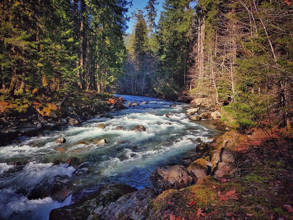
Cispus River
The Cispus River, a tranquil waterway that weaves through vast stretches of the Gifford Pinchot National Forest, offers a serene backdrop and an enticing melody for outdoor enthusiasts. Originating in the Cascades and flowing over 50 miles to its conclusion at Lake Scanewa, the river is adorned with several tributaries that converge in the Cowlitz Basin.
While fishing along the Cispus River can present some challenges, anglers have reported enjoying returns of brook trout in its waters. Public access to the Upper Cispus River is available by following U.S. Highway 12 to Randle, then taking State Route 131 south to Forest Road 23, and finally proceeding up Forest Road 21, which runs parallel to the river. Trout fishing is particularly prevalent during the summer and fall seasons, making the Cispus River an inviting destination for those seeking both natural serenity and angling experiences.
Covel Creek Falls & Angel Falls
Covel Creek Falls and Angel Falls, nestled in the East Lewis County region, offer a captivating hiking experience surrounded by the beauty of nature. The impressive Covel Creek Falls, cascading over a rock outcropping along the Covel Creek Trail, provides hikers with a stunning view of the forested landscape and the soothing sounds of nature in action.
For those embarking on the Covel Creek to Angel Falls hike, allocating 3-4 hours is advisable, making it a family-friendly adventure. The popular route involves turning right from Forest Road 28 to Cispus Road, locating parking near the Cispus Learning Center, and starting the journey on the Covel Creek Falls Trail. The trail winds through old-growth forest, crossing the stream at two points and guiding hikers up challenging switchbacks. Although demanding, the reward is the breathtaking Covel Creek Falls, making the entire trip to East Lewis County worthwhile.
Adjacent to Covel Creek, Angel Falls presents an impressive display as it cascades over granite slabs before joining Covel Creek. Hikers seeking an additional challenge can continue past Covel Creek Falls on the Covel Creek Trail, taking a left at the trail fork about a mile ahead to reach Angel Falls. Continuing further on the trail leads to Burley Mountain, home to a historic fire lookout offering panoramic views of the Cowlitz Valley, Cascades, and more. The Covel Creek to Angel Falls hike provides not only natural beauty but also opportunities for varied levels of hiking difficulty and exploration.

Cowlitz River
The Cowlitz River, stretching 105 miles in total, claims more than half of its length within Lewis County. This significant river has been strategically harnessed at various points to generate electricity for Tacoma Power. The construction of dams along the Cowlitz River led to the creation of Riffe Lake and Mayfield Lake, which stand as the region’s most frequented recreational lakes.
Anglers are drawn to the Cowlitz for its diverse stock of salmon, steelhead, and sturgeon, making it a prized destination for fishing enthusiasts. Beyond its appeal to anglers, the river is cherished for its tranquil surroundings, with campgrounds along the county providing peaceful retreats for generations of families. The Cowlitz River and its adjoining lakes serve as the backdrop for some of the finest recreational water activities available in Lewis County, offering a diverse range of outdoor experiences for locals and visitors alike.

Gifford Pinchot National Forest
Gifford Pinchot National Forest includes over 1.3 million acres of forest, wildlife habitat, watersheds & mountains, including Mt. Adams & Mount St. Helens National Volcanic Monument.

Goat Creek Trail/Cathedral Falls
Nestled just outside of Morton, the Goat Creek Trail stands out as one of the most breathtaking hikes in the Gifford Pinchot National Forest. Winding through stands of old-growth forest and crossing several small creeks, the trail leads intrepid hikers to its main attraction: Cathedral Falls.
Cathedral Falls, a natural wonder of Lewis County, impressively descends over 250 feet from a rock outcropping that extends over the trail. Adventurous hikers can venture to the bottom of the falls to capture stunning photos and explore the meeting point of the falls and Goat Creek.
Beyond Cathedral Falls, the Goat Creek Trail extends to Vanson Lake, a serene retreat secluded from much of civilization. This area permits camping and fishing, offering a peaceful escape. For those seeking panoramic views, Vanson Peak is in close proximity.
The family-friendly hike to Cathedral Falls is ideal for a day trip, allowing hikers to return to the Morton or Randle areas and enjoy the amenities they have to offer. With its combination of natural beauty and accessibility, the Goat Creek Trail provides a memorable outdoor experience in the heart of Lewis County.

High Rock Lookout Trail
The High Rock Lookout Trail is a moderately challenging hike with a length of approximately 3.2 miles one way. As you ascend, the trail gains elevation, featuring varying degrees of steepness in different sections.
The trail leads to the High Rock Lookout, a highlight of the hike, where hikers are rewarded with a spectacular panoramic view. From this elevated vantage point, Mount Rainier and the surrounding Cascade Mountains unfold in breathtaking splendor, offering a stunning visual treat for those who reach the lookout. The High Rock Lookout Trail stands as an engaging outdoor adventure, providing both a satisfying hike and a memorable viewpoint for nature enthusiasts.
Lewis and Clark State Park
Nestled in a scenic natural setting, Lewis and Clark State Park offers an ideal escape, especially on an 88-degree day. The park invites outdoor enthusiasts to explore its forested trails, providing a refreshing and invigorating experience.
Whether you’re donning hiking shoes or prefer an equestrian adventure, the park accommodates both preferences with eight miles of horse trails, ensuring visitors can tailor their outdoor activities to their liking.
Lewis and Clark State Park stands as a perfect destination for those seeking a rejuvenating day surrounded by nature’s beauty and tranquility.

McMurphy Park
As one of the newest additions to Lewis County, McMurphy Park stands out with its expansive 10.5 acres of open space, nestled along a picturesque stretch of Olequa Creek just north of Vader. The park offers a welcoming environment with barbeque pits and picnic tables, making it an excellent choice for a family barbecue or a leisurely picnic.
For a serene experience, visitors can stroll to the water’s edge at the park’s northern end, where the sounds of a waterfall echo—a reminder of Vader’s former name, “Little Falls.” McMurphy Park serves as a charming destination for outdoor gatherings and a peaceful retreat along the banks of Olequa Creek.
Meta Lake
Meta Lake, located just a quarter-mile from Forest Road 99, serves as a poignant testament to the remarkable regeneration of an ecosystem that endured the devastating 1980 eruption of Mount St. Helens. Despite its modest size, Meta Lake is a thriving habitat for aquatic life, surrounded to the south by a grove of evergreen trees that, remarkably, survived the eruption and were later blanketed in snow. This small lake stands as an oasis amid the once-barren landscape left by the volcanic blast.
Visitors can enjoy a brief stroll along the paved path, which is wheelchair accessible, leading to a viewing platform. From this vantage point, a picturesque scene unfolds, showcasing Meta Lake and the Norway Pass area to the north. The area bursts with life, featuring small toads, buzzing bees, and vibrant wildflowers—a vivid display of the ecosystem’s resurgence on the north side of the volcano.
Meta Lake stands as a living testament to nature’s resilience and the enduring beauty that can emerge from adversity.

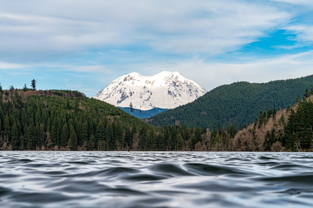
Mineral Lake
Mineral Lake, a beloved destination for anglers, offers a picturesque setting with Mount Rainier as a breathtaking backdrop. The lake, spanning 277 acres, presents visitors with a postcard-like scene, surrounded by resorts that enhance the overall experience. Renowned for its unrivaled scenic beauty, Mineral Lake stands out among Washington state’s lowland lakes, providing perfect views of the mountains.
Beyond its aesthetic appeal, Mineral Lake is a prime fishing destination in Lewis County, stocked annually with an abundance of trout. Whether fishing from the shoreline or a boat, enthusiasts can enjoy the tranquility of the lake while indulging in their favorite pastime. With the combination of stunning landscapes and excellent fishing opportunities, Mineral Lake stands as a gem among Washington’s scenic and recreational destinations.
Mount Adams
Mount Adams, also known as Pahto or Klickitat by some Native American tribes, stands as a potentially active stratovolcano within the Cascade Range. Despite having been dormant for over 1,000 years, it is not classified as extinct, making it a significant geological feature in the region. As the second-highest mountain in Washington, following Mount Rainier, Mount Adams was named in honor of President John Adams.
Situated approximately 34 miles east of Mount St. Helens, Mount Adams is a prominent member of the Cascade Volcanic Arc. Its expansive wilderness, known as the Mount Adams Wilderness, encompasses the upper and western sections of the volcano’s cone. The eastern side is designated as part of the territory of the Yakama Nation. With an asymmetrical and broad form, Mount Adams rises 1.5 miles above the Cascade crest. Its nearly flat summit, shaped by cone-building eruptions from separated vents, adds to the mountain’s unique profile.
Notably, the Pacific Crest Trail traverses the western flank of Mount Adams, offering hikers a chance to experience the scenic beauty and geological significance of this majestic volcano in the Cascade Range.

Mount Rainier
Mount Rainier, the crown jewel of Washington State, stands as the most iconic natural landmark, captivating all who behold its majestic beauty. Soaring to an elevation of over 14,000 feet, the mountain’s grandeur is unrivaled, making it a prominent feature in the United States landscape.
As the centerpiece of Mount Rainier National Park, which spans more than 369 square miles across Lewis and Pierce counties, Mount Rainier offers a diverse and expansive natural playground. The park boasts an extensive network of hiking trails, including challenging routes leading to the summit—a mountaineering feat considered a lifetime accomplishment.
Visitors to Mount Rainier National Park can immerse themselves in lush forests, trace the paths of meandering rivers, and appreciate the stunning scenery that evolves with each season. Whether exploring vibrant wildflower meadows, glistening glaciers, or snow-covered landscapes, Mount Rainier promises a wealth of experiences for all seasons, making it a destination that beckons nature enthusiasts and adventurers alike.

Mount Rainier National Park
Mount Rainier National Park, a treasure in Washington State, encompasses vast areas in Lewis County, particularly southeast of Paradise, a major tourist attraction at Rainier. Notably, a significant portion of Chinook Pass and the acclaimed Stevens Canyon Road, renowned for its scenic beauty, are nestled in the northeast corner of Lewis County.
Access to Mount Rainier is facilitated through the Ohanapecosh entrance, conveniently reached from Packwood, just under a 30-minute drive east on Highway 12, followed by a northward turn up State Route 123. This route into the park, particularly in spring, summer, and fall, treats travelers to views of waterfalls, pristine creeks, lakes, and other natural wonders nourished by Rainier’s glaciers.
An alternative entrance, the Nisqually entrance, lies in Pierce County and is accessible by taking State Route 7 north through Morton and then east on State Route 706 through Ashford.
Mount Rainier National Park is a haven for outdoor enthusiasts, offering an extensive network of hiking trails, with the 90-mile Wonderland Trail encircling the mountain. In the summer, hiking and camping take center stage, while winter transforms the landscape into a snowy wonderland, perfect for snowshoeing. Additionally, the Paradise area opens a snowplay zone, providing opportunities for sledding and tubing—a must-do winter adventure in the region.
Whether exploring waterfalls, hiking trails, or enjoying winter activities, Mount Rainier National Park offers a diverse range of experiences for visitors year-round.

Mount St. Helens
Mount St. Helens is a prominent tourist destination in Lewis County. The county stands as the gateway to the mountain’s east and south sides, offering diverse experiences for visitors.
Embark on the route through Randle to Windy Ridge for a rugged and adventurous view, ideal for hikers, mountain bikers, and those seeking an adrenaline-fueled experience. As you journey through the Gifford Pinchot National Forest, witness the abrupt transition from lush greenery to the seemingly deserted blast zone, where you can explore surrounding trails and witness the regeneration of life through resilient plants and animals that now call the mountain’s shadow home.
For a family-friendly day tour, consider the route through Toledo, providing access to Johnston Ridge. Here, visitors can immerse themselves in the grandeur of Mount St. Helens, as Johnston Ridge is home to a major visitor center and offers a perfect vantage point to observe the massive crater created during the 1980 eruption. Whether seeking adventure or a family outing, Mount St. Helens invites exploration and a glimpse into the dynamic forces of nature.

Pacific Crest Trail
The Pacific Crest Trail (PCT) beckons adventurous hikers to embark on a 2,750-mile journey, attracting thousands of enthusiasts seeking the thrill of exploration. For those interested in discovering the scenic beauty of east Lewis County, the PCT provides a vital pathway to experience the region’s diverse landscapes.
As the trail winds its way through the high country of the Gifford Pinchot National Forest, Goat Rocks Wilderness, and other picturesque areas, hikers are treated to a mesmerizing journey. The undulating terrain offers the perfect vantage point to appreciate the breathtaking scenery, including panoramic views of Mount Adams and its surrounding areas.
These high elevations form the pinnacle of Lewis County’s natural wonders, making the Pacific Crest Trail an integral part of the adventure for those seeking an immersive and challenging hiking experience.

Packwood Lake Trail
The Packwood Lake Trail, starting just outside of Packwood, leads hikers on a picturesque 7.5-mile round trip journey to a pristine and nearly crystal-clear lake. This family-friendly trail traverses a corner of the Goat Rocks Wilderness, guiding adventurers through wooded landscapes before unveiling the historic Packwood Lake, once the site of a resort. Nestled at the lake’s edge is a century-old guard station, now listed in the National Register of Historic Places.
As hikers reach Packwood Lake, they are treated to panoramic views, capturing the serene beauty of Agnes Island at the lake’s center, surrounded by the scenic expanse of the Goat Rocks Wilderness. The landscape, adorned with hills, trees, and mountains, provides a perfect opportunity for photographers.
The Packwood Lake Trail stands as a rewarding adventure, inviting hikers to explore the natural wonders of Lewis County and capture the essence of this pristine wilderness.
Rainbow Falls State Park
Nestled in natural splendor, Rainbow Falls State Park beckons outdoor enthusiasts with its diverse offerings. Boasting several miles of hiking trails, the park provides a picturesque day-use area, ideal for picnics and gatherings, and offers forested campsites for those seeking a serene overnight stay. Fishing enthusiasts will find ample opportunities along the Chehalis River, adding to the park’s recreational allure.
Nature enthusiasts can delve into the secrets of the old-growth forests through self-interpreted nature walks or venture towards the river to witness the small yet fast-flowing Rainbow Falls. Picnic shelters dot the landscape, and the Oxalis Loop trail on the north side of Highway 6 offers a perfect short nature walk.
With a total of 53 campsites, including options for horses, hikers, bikers, and RVs, Rainbow Falls State Park caters to various preferences. Additionally, just across Leudinghaus Road from the park entrance, the Willapa Hills Trail awaits exploration. This former railroad, now a recreational trail, is perfect for bicycling, horseback riding, walking, or running, providing a convenient and diverse outdoor experience for visitors.

Rose Park
Rose Park, situated 2 miles west of Adna on Penning Rd (off State Highway 6), spans 21 acres and is a delightful destination for outdoor activities.
Open on weekends from Memorial Day through Labor Day, the park offers a range of amenities for visitors. Whether you’re looking to enjoy a picnic, explore hiking trails, play on the playground, or engage in recreational activities like volleyball and horseshoes, Rose Park provides a welcoming environment.
The park features a covered shelter, an exercise trail, and a group picnic area for larger gatherings. The group use area boasts a 34 square foot concrete slab located west of the kitchen shelter, equipped with eight picnic tables and large barbecues. Rose Park offers a serene and well-equipped space for individuals and groups to enjoy the outdoors in Lewis County.
Skate Creek
Skate Creek, meandering through the verdant expanse of the Gifford Pinchot National Forest near Packwood, emerges as a tranquil haven for nature enthusiasts. The crystal-clear waters of the creek, set against enchanting surroundings, create an idyllic setting for outdoor activities.
Whether casting a line for fishing, enjoying a leisurely picnic, or taking a peaceful stroll along its banks, Skate Creek invites visitors to immerse themselves in the natural beauty of the Gifford Pinchot National Forest. With its serene ambiance and picturesque landscape, Skate Creek stands as a charming destination for those seeking a peaceful escape into nature in the heart of Lewis County.
Skookumchuck River
The Skookumchuck River, originating in Thurston County, meanders through Centralia, coursing through the city until it converges with the Chehalis River near Mellen Street and Interstate 5. Known for its recreational opportunities, locals are familiar with the river’s charms.
Access to the Skookumchuck River is facilitated through the lesser-known Wilbur Parkins Park in Centralia, situated just off Magnolia Avenue in the Logan District. This park provides a gateway for residents and visitors to enjoy the scenic beauty and outdoor activities offered by the Skookumchuck River in the heart of Lewis County.

Walupt Lake
Nestled in a vast expanse of forestland, the Walupt Lake region offers serenity to those seeking a summer retreat. Known for its tranquil ambiance, the lake provides a picturesque setting with opportunities for various recreational activities.
Walupt Lake is renowned for its fishing opportunities, boasting cutthroat and rainbow trout within its waters. A convenient boat launch at the lake invites visitors to bring their boats, kayaks, or canoes for a peaceful excursion on the open waters.
For those exploring the backroads of the Gifford Pinchot and Goat Rocks, a day-use picnic site at the campground provides a convenient stop for a short and enjoyable break. With its serene environment and diverse recreational offerings, Walupt Lake stands as a charming destination in Lewis County during the summer months.
White Pass Scenic Byway
The White Pass Scenic Byway, a captivating stretch of U.S. Highway 12, winds through East Lewis County, offering a gateway to volcano country and the expansive Gifford Pinchot National Forest. Stretching over 100 miles, this scenic roadway is a paradise for outdoor and scenery enthusiasts, showcasing the natural beauty of the region.
Starting east of the U.S. 12 intersection with Jackson Highway and concluding in Yakima County near Naches, the Byway provides numerous connections to recreational opportunities. Along the route, travelers can explore Mayfield, Riffe, and Scanewa lakes, each offering prime opportunities for swimming, fishing, and camping. The Byway follows the Cowlitz River, granting access to the Tilton and Cispus rivers in East Lewis County.
Communities such as Mossyrock, Morton, Randle, Packwood, and more thrive in connection to the Byway, each contributing to the overall charm of the region.
With its diverse offerings and access to some of the most-visited attractions in Lewis County, the White Pass Scenic Byway invites exploration over multiple days and trips, ensuring a memorable journey through the picturesque landscapes of this part of Washington State.

White Pass Ski Area
White Pass Ski Area beckons winter enthusiasts to embark on an unforgettable adventure in the snowy landscapes. Set against the majestic backdrop of Mt. Rainier, visitors can carve groomers in Paradise Basin, tackle the steeps off the West Ridge, or explore the epic front side of Pigtail Peak. With a commitment to fostering a relaxed and family-friendly atmosphere, White Pass Ski Area caters to skiers and riders of every ability. Whether seeking the thrill of challenging slopes or enjoying a leisurely day on the snow, White Pass offers a winter wonderland that embraces the diverse preferences of all who venture to this iconic ski destination.


Willapa Hills Trail
The Willapa Hills Trail, officially known as Willapa Hills State Park Trail, spans 56 miles, providing a non-motorized pathway for travelers between Chehalis and the Willapa Bay area near the Pacific Ocean. With 22 miles continuously accessible from Chehalis to Pe Ell, the trail has become a prime destination for cyclists, horseback riders, and day hikers seeking a relatively flat and gently rolling trail experience.
Under the oversight and patrolling of Washington State Parks, the trail is well-maintained, ensuring a smooth journey. As it meanders next to historic farms, through lush wooded areas, and along the scenic Chehalis River, the trail offers an escape from urban life, allowing visitors to immerse themselves in the tranquility of the countryside. For a coastal adventure, camp at Rainbow Falls State Park in the Doty area, where prime camping spots are available alongside a small waterfall.
The Willapa Hills Trail accommodates horseback riders, offering enough clearance for a softer ground experience while following the trail’s path. Cyclists are recommended to use bikes other than lightweight road bikes, as the majority of the trail consists of finely crushed ballast and gravel, making it ideal for fat-tire bicycle enthusiasts. With its diverse offerings and well-maintained conditions, the Willapa Hills Trail is a picturesque and inviting route for outdoor enthusiasts in West Lewis County.

Windy Ridge Viewpoint
Windy Ridge Viewpoint, situated just six miles from the crater of Mount St. Helens, offers a prime vantage point for observing the iconic volcano from the east. Accessible by car, it provides the closest view, allowing visitors to witness the aftermath of the eruption that occurred over three decades ago.
Even from the comfort of the vehicle, visitors are treated to a stunning panorama of the massive mountain and the north side that was impacted by the blast.

Cascade Range
The Cascade Range, a prominent mountain range in western North America, spans from southern British Columbia through Washington and Oregon to Northern California. Comprising both non-volcanic mountains, notably in the North Cascades, and significant volcanoes referred to as the High Cascades, it showcases diverse geological features.
Mount Rainier, towering at 14,411 feet (4,392 m), stands as the highest peak in this expansive range.


Chehalis River
The Chehalis River, located in Washington, USA, has its source in various forks in southwestern Washington. It follows an eastward, then northward, and finally westward course in a sweeping curve before ultimately emptying into Grays Harbor, a Pacific Ocean estuary.
Remarkably, the Chehalis River boasts the distinction of being the largest solely contained drainage basin in the state. Notably, the river serves as a crucial habitat for various salmon species, with Chinook salmon being particularly prevalent in its waters.
Cowlitz River
The Cowlitz River, situated in the state of Washington, USA, serves as a significant tributary to the Columbia River. Originating from tributaries that drain a vast region encompassing the slopes of prominent peaks such as Mount Rainier, Mount Adams, and Mount St. Helens, the river plays a crucial role in the regional watershed.
Nisqually River
The Nisqually River, stretching approximately 81 miles in west central Washington, serves as a vital waterway. It drains a region in the Cascade Range southeast of Tacoma, encompassing the southern slope of Mount Rainier.
The river ultimately flows into the southern end of Puget Sound, contributing to the intricate water system of the area.

Big Horn
Big Horn, an officially unnamed peak in the Cascade Range in Washington, stands as the highest point in Lewis County. As one of the Goat Rocks and the second highest point on the ridge west of Gilbert Peak in the Goat Rocks Wilderness, Big Horn is known for its challenging terrain.
Situated just west of the highest point on the ridge, Goat Citadel, it features a 10-foot vertical crack near its summit, rated as a difficult class 4 pitch by Fred Beckey.
Renowned for being the most challenging section on the easiest routes to Washington’s 39 county high points, Big Horn offers a demanding ascent for climbers.
Gifford Pinchot National Forest
Gifford Pinchot National Forest, a sprawling expanse of 1.32 million acres in southern Washington, falls under the stewardship of the United States Forest Service. Extending 116 km along the western slopes of the Cascade Range from Mount Rainier National Park to the Columbia River, the forest encompasses diverse landscapes, including expansive old-growth forests, high mountain meadows, glaciers, and numerous volcanic peaks. Its highest point, Mount Adams, stands at 12,276 ft, making it the second tallest volcano in the state after Mount Rainier.
Commonly abbreviated as GPNF, the forest is home to the congressionally established 110,000-acre Mount St. Helens National Volcanic Monument since 1982. Noteworthy features within the forest include the Dark Divide Roadless Area, Silver Star Scenic Area, lava tubes, caves, and casts (including the famed Ice Caves), Ape Caves, Midway High Lakes Area, Big Lava Bed, Packwood Lake, Sawtooth Berry Fields, designated huckleberry fields reserved for Yakima tribe use since 1932, Lone Butte Wildlife Emphasis Area, and Layser Cave—a historic dwelling site for Native Americans dating back 7,000 years.
This diverse and expansive forest offers a rich tapestry of natural wonders and cultural significance.
Mount Baker–Snoqualmie National Forest
The Mount Baker–Snoqualmie National Forest, located in Washington, is a vast expanse extending over 140 miles along the western slopes of the Cascade Range, from the Canada–US border to the northern boundary of Mount Rainier National Park. Administered by the United States Forest Service and headquartered in Everett, the forest covers portions of Snohomish, Whatcom, Skagit, King, Pierce, and Kittitas counties, totaling an area of 1,724,229 acres.
Comprising four ranger districts from north to south—the Mount Baker, Darrington, Skykomish, and Snoqualmie—the forest features ranger stations strategically located across its expansive terrain. Boasting proximity to a significant portion of the state’s population, with 62% (3.63 million people) residing within a 70-mile drive, and an additional 1.5 million in the Vancouver metropolitan area easily accessible to the northern part of the forest, the Mount Baker–Snoqualmie National Forest stands as the most visited national forest in the country.
This popularity is attributed to its large population catchment and convenient road access, making it a highly frequented destination for outdoor enthusiasts.


Mount Rainier National Park
Mount Rainier National Park, situated in southeast Pierce County and northeast Lewis County, Washington, is a captivating American national park. Dominated by the majestic Mount Rainier, the park boasts elevations ranging from 1,600 feet to over 14,000 feet, marking the highest point in the Cascade Range. The mountain’s imposing presence is complemented by picturesque landscapes featuring valleys, waterfalls, subalpine meadows, and an expansive 91,000 acres of old-growth forest.
The park’s topography is further enhanced by the presence of over 25 glaciers that descend the flanks of Mount Rainier. Despite its grandeur, the mountain is often veiled in clouds, contributing to its mystique. These clouds also bring substantial rainfall and snowfall to the region.
Mount Rainier National Park stands as a haven for natural beauty, offering a diverse and awe-inspiring environment for visitors to explore.
Mount St. Helens National Volcanic Monument
The Mount St. Helens National Volcanic Monument, located in Washington, is a designated U.S. National Monument encompassing the area surrounding Mount St. Helens. Spanning 110,000 acres, the monument serves as a dedicated space for research, recreation, and education.
Within its boundaries, the environment is allowed to respond naturally to the volcanic disturbance, providing a unique opportunity to witness the regenerative processes and ecological changes in the aftermath of the historic eruption.
The Mount St. Helens National Volcanic Monument stands as a testament to the power of nature and the ongoing processes of recovery and renewal.