Every year it seems for as long as I can remember property taxes have increased.
Did you know that doesn’t have to be the case?
In this article you’ll learn if you qualify to save hundreds if not thousands of dollars EVERY YEAR!!
For the rest of your life!
Skagit County, Washington gives senior citizens and disabled persons tax relief programs that reduce the amount of their payment of property taxes. To be eligible for this program, you must meet the qualifications based on your age or disability, ownership, occupancy, and income.
You may be qualified for a deduction on your property taxes if by December 31 of the assessment year, you are either at least 61 years of age; unable to work because of a disability; or a disabled veteran with a service-connected evaluation of at least 80% or receiving compensation from the United States Department of Veterans Affairs at the 100% rate for a service-connected disability.
You must also own your home by December 31 of the assessment year and occupy the same for more than six months in the assessment year. You could still qualify for this program even if you spent time in a hospital, nursing home, boarding home, adult family home, or home of a relative. However, a residence used as a vacation home is not eligible.
Additionally, your combined disposable income should not exceed $48,000 starting in 2024.
If you think you are qualified, schedule an appointment with us and we will help you receive this benefit.
In Skagit County, property taxes are due as soon as the bills are certified and mailed. You can pay the first installment of your property taxes that are to be received with a postmark date all the way up to April 30 of each year. If you choose to pay the year in full, that payment can also be made through April 30 each year. If you choose to pay in two installments, the second payment can be made all the way through October 31. If the final pay dates fall on a holiday or weekend, then taxes become due on the next business day.
You have the option of paying your property taxes online or by phone. Whether you choose online payment or by phone, the county’s official payments partner, Official Payments Corp., has a step-by-step guide on how to proceed with your payment. Just head over to the county’s official website.
So, if you want to reduce the amount of your payment in property taxes, take advantage of Skagit County’s tax relief programs. Schedule a quick consultation with us and we will help you all the way.
About Skagit County
Skagit County, located in the state of Washington, was established in 1883, carved out of Whatcom County1https://en.wikipedia.org/wiki/Skagit_County,_Washington. Named after the indigenous Skagit Indian tribe, present in the area prior to European-American settlement, the county had a population of 129,523 as per the 2020 census. In 2010, the population stood at 116,901, with 45,557 households and 30,656 families. The county is characterized by a population density of 67.5 people per square mile (26.1 people/km2) and boasts 51,473 housing units at an average density of 29.7 units per square mile (11.5 units/km2). Skagit County’s history, marked by its formation in the late 19th century and its ties to the indigenous Skagit tribe, contributes to its cultural and demographic identity in the state of Washington.
Places You Could Visit
Northern State Recreation Area
The Northern State Recreation Area (NSRA) is a 726-acre regional recreation facility developed by Skagit County in Washington. Acquired in 1991 from the State of Washington, the site was formerly part of the Northern State Hospital’s working farm, which closed in the 1970s.
Located on the eastern edge of Sedro-Woolley’s urban growth area, at the foothills of the Cascade Mountains, NSRA offers a picturesque setting. The area includes abandoned dairy barns built in 1921, perched on a plateau overlooking the southern meadows.
This recreational space serves as a valuable asset for the citizens of Skagit County and beyond, providing an opportunity for outdoor activities in a historic and scenic environment.
Padilla Bay Shore Trail
The Padilla Bay Shore Trail is a 2.25-mile dike-top pathway designed for both bicyclists and pedestrians. This trail provides a scenic route along the estuary of the Skagit River, renowned as the most diverse, least disturbed, and biologically productive of all major estuaries on Puget Sound. Padilla and Samish Bay, through which the trail passes, host one of the largest known wintering populations of peregrine falcons in North America, including an endangered subspecies. The western portion of the county sees the winter presence of ten types of raptors, featuring species such as peregrine falcons, merlins, and snowy owls.
Remarkably, the Padilla Bay area has reported sightings of all five species of falcons in a single day, making the trail not only a recreational haven but also a prime location for observing diverse birdlife, particularly raptors.
Cascade Range
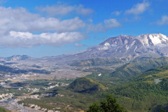
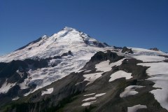
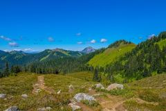
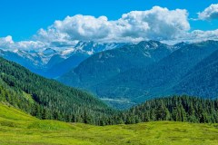
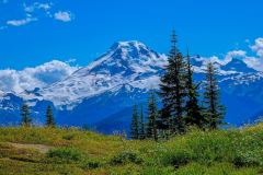
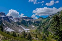
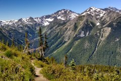
The Cascade Range, often referred to as the Cascades, stands as a prominent mountain range in western North America, stretching from southern British Columbia through Washington and Oregon to Northern California. This extensive range encompasses both non-volcanic mountains found in the North Cascades and the renowned volcanic peaks known as the High Cascades.
As a significant geological feature, the Cascades are integral to the Pacific Ocean’s Ring of Fire, a region encircling the Pacific Ocean known for its volcanoes and associated mountain ranges. Within the Cascade Range lie several national parks and protected areas, including the North Cascades National Park, Mount Rainier National Park, Crater Lake National Park, and Lassen Volcanic National Park. The northern segment of the Pacific Crest Trail follows the scenic path of the Cascade Range, showcasing the natural beauty and diverse landscapes that define this majestic mountain range.
Fir Island
Fir Island, situated in the southwestern corner of Skagit County, Washington, is delineated by the North and South Forks of the Skagit River and Skagit Bay of Puget Sound. With a triangular outline measuring 5.3 miles east–west by 6.5 miles north–south, encompassing nearly 9,900 acres, the island is home to 195 families. Linked by a bridge to Conway on the east shore of the South Fork of the Skagit River and another bridge across the North Fork leading to La Conner 3.7 miles northwest, Fir Island enjoys a strategic location in the region.
Notably, the northeast tip of Fir Island holds historical significance as the site of Skagit City, a 19th-century town that experienced decline after the removal of log jams upstream in 1877. Today, Fir Island stands as a distinctive landmass with connections to neighboring villages and a history that echoes the changes in the landscape over time.
Fidalgo Island
Fidalgo Island, situated approximately 60 miles north of Seattle in Skagit County, Washington, is home to its largest and sole city, Anacortes. According to the 2020 census, Anacortes has a population of 17,637 residents. Anacortes serves as a gateway to nearby destinations, offering daily ferry services to the San Juan Islands and Guemes Island, enhancing the island’s connectivity and making it a hub for transportation and exploration in the region.
Sauk River
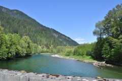
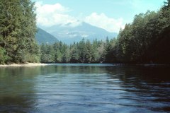
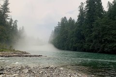
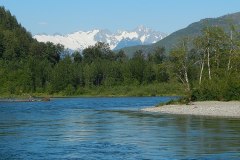
The Sauk River, a tributary of the Skagit River in northwestern Washington, spans approximately 45 miles and flows through the high Cascade Range in the Puget Sound watershed north of Seattle. Renowned for its scenic beauty and recreational opportunities, the river is particularly popular for fly fishing. Designated as a National Wild and Scenic River, the Sauk River holds special significance for its protected status, emphasizing the importance of preserving its natural and recreational values.
Skagit River
The Skagit River, flowing through southwestern British Columbia in Canada and northwestern Washington in the United States, spans approximately 150 miles. The river’s watershed experiences a temperate, mid-latitude, maritime climate, leading to varying temperatures throughout the year, with peak warmth in July and lowest temperatures in January.
In 1978, the U.S. Congress established the Skagit Wild and Scenic River System, encompassing 158.5 miles of the Skagit and its tributaries—the Sauk, Suiattle, and Cascade rivers. This designation aims to safeguard and enhance the intrinsic values that led to its listing, focusing on preserving the free-flowing characteristics and water quality of the rivers, as well as the outstandingly remarkable wildlife, fish, and scenic qualities within the Skagit watershed.
Buckner Mountain
Buckner Mountain, also known as Mount Buckner, stands as a prominent peak in the North Cascades of Washington, situated within the Stephen Mather Wilderness of North Cascades National Park. Ranking as the 14th highest peak in the state, it holds the distinction of being the third highest peak within the national park.
Notably, Buckner Mountain is recognized for its relative accessibility compared to other high peaks in Washington. Positioned just east of Cascade Pass and boasting a well-maintained trail, it provides a more approachable route for those seeking to explore the stunning landscapes of the North Cascades region.
Mount Baker–Snoqualmie National Forest
The Mount Baker–Snoqualmie National Forest in Washington is a vast expanse of natural beauty, extending over 140 miles along the western slopes of the Cascade Range from the Canada–US border to the northern boundary of Mount Rainier National Park. Encompassing portions of Snohomish, Whatcom, Skagit, King, Pierce, and Kittitas counties, this national forest spans a total area of 1,724,229 acres.
Structured into four ranger districts from north to south, the Mount Baker–Snoqualmie National Forest includes the Mount Baker District with ranger stations in Glacier and Sedro-Woolley, the Darrington Ranger District with stations in Darrington and Verlot, the Skykomish Ranger District with a station in Skykomish, and the Snoqualmie Ranger District with stations in North Bend and Enumclaw. Renowned for its diverse landscapes and recreational opportunities, this national forest serves as a natural haven for visitors to explore and enjoy the wonders of the Cascade Range.
North Cascades National Park
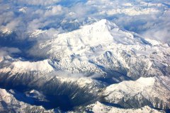
North Cascades National Park, the largest unit within the North Cascades National Park Complex in Washington, spans over 500,000 acres, showcasing the rugged beauty of the North Cascades Range. The park is divided into northern and southern sections by the Skagit River, flowing through the reservoirs of Ross Lake National Recreation Area. Additionally, Lake Chelan National Recreation Area borders the southern edge of the south unit.
Boasting the most expansive glacial system in the contiguous United States, North Cascades National Park features towering mountain peaks, pristine waterways, and vast forests with the highest flora biodiversity among American national parks. The park is surrounded by protected lands, including national forests, wilderness areas, and Canadian provincial parks in British Columbia.
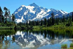
Visitors to North Cascades National Park enjoy the absence of entrance fees, and vehicle-accessible trailheads do not require parking passes. Iconic features include Mount Shuksan, the second-highest peak in the park at 9,131 feet. Hikers and backpackers often explore Cascade Pass in the southwestern section of the southern unit, a historic travel route used by Native Americans. With nearly 400 miles of hiking trails, the park offers access to two National Scenic Trails—the Pacific Crest Trail and the Pacific Northwest Trail.
North Cascades National Park is a haven for climbing enthusiasts, featuring high-quality routes on cliffs and ice formations. Popular backcountry camping zones include the north and south Picket Ranges, Mount Triumph, Eldorado Peak, and Boston Peak regions. The park’s diverse landscapes and recreational opportunities make it a compelling destination for outdoor enthusiasts and nature lovers alike.
Ross Lake National Recreation Area
Ross Lake National Recreation Area, nestled in the Northern Cascades, stands as a premier destination for outdoor enthusiasts, drawing visitors from both the United States and Canada. Boasting a range of recreational activities, the area offers opportunities for fishing, hunting, canoeing, kayaking, climbing, and hiking. The NRA serves as a gateway to an extensive network of trailheads, connecting visitors to hundreds of miles of hiking trails in adjacent areas such as North Cascades National Park, Pasayten Wilderness, and Skagit Valley Provincial Park.
Campers can find accommodations in National Park Service campgrounds along the North Cascades Highway, including Newhalem Creek, Colonial Creek, and Goodall Creek. These campgrounds provide options for both tent and RV camping. Along the picturesque Ross Lake and Diablo reservoirs, visitors can indulge in boat-in camping experiences, with permits available from the Wilderness Information Center in Marblemount, Washington.
Ross Lake National Recreation Area’s diverse offerings, coupled with its scenic landscapes and convenient access to neighboring wilderness areas, make it a popular destination for those seeking a range of outdoor adventures in the heart of the Northern Cascades.
Pacific Northwest Trail
The Pacific Northwest Trail (PNT) is a remarkable 1,200-mile hiking trail that spans from the Continental Divide in Montana to the picturesque Pacific Ocean on the Olympic Coast of Washington. As it winds its way through diverse landscapes, the PNT takes hikers through three national parks, seven national forests, and intersects with two other national scenic trails. The trail’s unique route challenges adventurers by traversing against the grain of various mountain ranges, including the Continental Divide, Whitefish Divide, Purcells, Selkirks, Kettles, Cascades, and Olympics. With its extensive journey and diverse scenery, the Pacific Northwest Trail offers hikers an unforgettable experience connecting the heartland of America to the stunning coastal landscapes of the Pacific Northwest.

