
Every year it seems for as long as I can remember property taxes have increased.
Did you know that doesn’t have to be the case?
In this article you’ll learn if you qualify to save hundreds if not thousands of dollars EVERY YEAR!!
For the rest of your life!
Skamania County, Washington has available tax relief programs for senior citizens and disabled persons. By taking advantage of this program, you will receive a deduction on your property taxes. However, you must qualify in order to get a discount.
If you are 61 years old by December 31 during the year you filed the claim for reduction or are retired from gainful, regular employment due to a disability, you may be entitled to a reduction on your property taxes.
Additionally, you must be the owner/buyer or have a life estate in the property and the property should be your primary residence.
Also, your combined gross income should be $58,000 or less starting in 2024.
So, if you believe you qualify for a discount on your property taxes in Skamania County, schedule a quick consultation with us and we will help you get this benefit.
As of this writing, the County’s average property tax is pegged at the rate of 1.01%. But if you take advantage of their discounts, you could pay lower property taxes than the usual.
Here at Property Tax Discount, we can help you get a discount on your property taxes. Schedule an appointment with us today.
About Skamania County
Skamania County, situated in the state of Washington, is home to a population of 12,036 as of the 2020 census1https://en.wikipedia.org/wiki/Skamania_County,_Washington. Established in 1854, the county derives its name from the Cascades Chinook word “sk’mániak,” signifying “swift waters.”
In 2010, the county recorded a population of 11,066 residents, residing in 4,522 households and 3,072 families. The area’s population density is approximately 6.7 people per square mile (2.6 people/km2), with 5,628 housing units averaging 3.4 units per square mile (1.3 units/km2). Skamania County’s history, founded in the mid-19th century, and its native-inspired name reflect the cultural and geographical influences shaping the region in southwestern Washington.
Places You Can Visit
Cascade Range
The Cascade Range, often referred to as the Cascades, is a significant mountain range in western North America, stretching from southern British Columbia through Washington and Oregon to Northern California. This expansive range encompasses both non-volcanic mountains, as seen in the North Cascades, and prominent volcanic peaks known as the High Cascades. In British Columbia, the range is locally known as the Cascade Mountains or the Canadian Cascades.
Notably, the highest peak within the Cascade Range is Mount Rainier, soaring to an elevation of 14,411 feet (4,392 meters). The diversity of landscapes, including both volcanic and non-volcanic formations, contributes to the scenic beauty and geological richness of the Cascade Range, making it a distinctive feature of the western North American landscape.


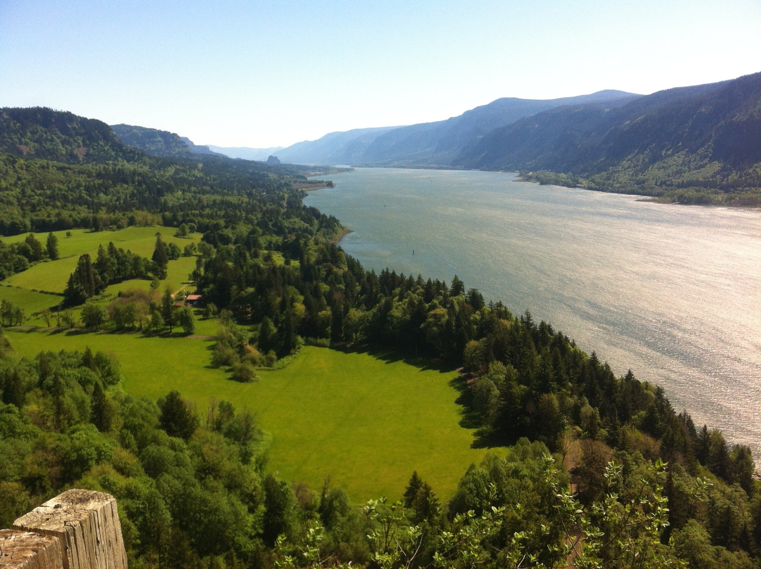
Columbia River
The Columbia River, the largest river in the Pacific Northwest region of North America, originates in the Rocky Mountains of British Columbia, Canada. Flowing initially northwest and then south into the U.S. state of Washington, the river takes a westward turn, forming the majority of the border between Washington and Oregon before finally emptying into the Pacific Ocean. Extending 1,243 miles (2,000 kilometers), the Columbia River boasts the Snake River as its largest tributary.
The river’s drainage basin is expansive, covering an area roughly the size of France and stretching into seven states of the United States and one Canadian province. As the fourth-largest river in the United States by volume, the Columbia River holds the distinction of having the greatest flow of any river entering the Pacific outside of Asia and ranks as the 36th river globally in terms of discharge. With its extensive length, influential tributaries, and vital role in the region’s geography, the Columbia River stands as a prominent and significant watercourse in North America.


Mount St. Helens
Mount St. Helens, known as Lawetlat’la to the Cowlitz people and Loowit or Louwala-Clough to the Klickitat, is an active stratovolcano located in Skamania County, Washington, within the Pacific Northwest region of the United States. Situated 52 miles northeast of Portland, Oregon, and 98 miles south of Seattle, Mount St. Helens is part of the Cascade Volcanic Arc, a segment of the Pacific Ring of Fire.
Named after British diplomat Alleyne Fitzherbert, 1st Baron St Helens, by explorer George Vancouver, Mount St. Helens is a popular climbing destination for mountaineers of varying experience levels. Climbing permits have been required since 1987 for elevations above 4,800 feet. The standard Monitor Ridge Route is a common choice in warmer months, starting at the Climbers Bivouac and involving steep, rugged terrain, while the Worm Flows Route is the standard winter route, gaining about 5,700 feet in elevation over 6 miles.
The Loowit Trail circles the mountain at elevations of 4,000–4,900 feet, with a restricted zone in the northern segment. A visitor center in Silver Lake, Washington, operated by Washington State Parks, offers exhibits, including a volcano model, seismograph, theater program, and an outdoor natural trail, providing visitors with insights into the geological and natural history of Mount St. Helens.


Indian Heaven
Indian Heaven, located in Skamania County, Washington, is a volcanic field characterized by six small shield volcanoes trending north to south. Dominated by shields crowned with spatter and cinder cones, the field includes subglacial volcanoes and tuyas. Lemei Rock, the highest point at 5,925 feet, stands among notable peaks such as Sawtooth Mountain and Red Mountain.
Nestled within the Indian Heaven Wilderness, the area provides a range of outdoor activities, including fishing in lakes and ponds, hiking, backpacking, horseback riding, and wildlife viewing. The Indian Heaven loop, a popular 10-mile trail, begins at Cultus Creek campground, traversing meadows and lakes to join the Pacific Crest Trail before returning to the starting point.
Additional trails like Lake Wapiki (9.6 miles) offer scenic views of Mount Adams and Mount Rainier, while the Blue Lake trail (3.25 miles) forms a loop with Lemei Lake Trail, showcasing lakes, meadows, and forests. Notable fishing spots like Dee Lake, Heather Lake, Thomas Lake, and Eunice Lake attract visitors, with Blue Lake standing as the deepest lake in the wilderness at 46 feet.
Goose Lake Campground, a popular camping spot, serves fishermen, boaters, and swimmers and operates from July to October under the United States Forest Service. To manage high-use areas and reduce environmental impact, designated campsites near Thomas and Blue Lakes were created by the Gifford Pinchot National Forest.
Indian Heaven’s diverse trails, lakes, and camping facilities make it a sought-after destination for outdoor enthusiasts, offering both scenic beauty and recreational opportunities.